The Dolomites are well known to backpackers, skiers, and other outdoor enthusiasts from around the world. I’ve been planning to hike there for years. This was the year, with backpacking gear on hand from a recent Balkan hike with Bill Ramsey. The two hikes were relatively close to each other, and we made productive use of the time in between with some meandering in Croatia and Slovenia. There are many hikes that criss-cross the Dolomite region. We settled on the Short Alta Via 1, a four-day trek that gave a good sample of the region (Alta Via translates to “high way” in Italian).
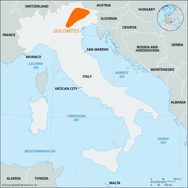
First a little background. What are the Dolomites? A spectacular mountain range located in the Alps of Northeast Italy, they were designated a UNESCO World Heritage Site in 2009 for their exceptional natural beauty and significant geologic science value. They are named for the dolomite limestone from which they formed about 250 million years ago. During this time, the area was submerged in a warm, shallow tropical sea where coral reefs thrived. Over millions of years, these reefs and other marine sediments were compressed and solidified into the dolomite rock that makes up the mountains. Over their history, the sedimentary rock eroded in a manner leaving the light-colored jagged peaks that attract tourists from around the world. There are 18 peaks over 10,000 feet. Certainly impressive, but considerably shorter (and much older) than the European Alps.
Good visual of sedimentary layers.
The starting point for the Short Alta Via 1 was the town of Cortina d’Ampezzo. an upscale resort surrounded by mountains that stays busy with both summer and winter tourists. Events were held here for the 1956 Winter Olympics, and the town was abuzz with construction preparing for events in the upcoming 2026 Winter Olympics. We arrived in Cortina d’Ampezzo from Venice on a comfortable 3-hour bus ride. Our hike started and ended here at the Hotel Aquilla.
Hotel Aquilla
Cortina d’Amprezzo with Tofana Ski Slopes in background
I booked this trip through bookatrekking.com. They are a large outfit with hiking packages all over the world. I was happy with them. Payments were easy and I thought reasonable. The mobile app contained a lot of information, including an offline mode that allowed you to track the hike (and hike profile) using gps. I wouldn’t hesitate to use them again.
Day 1 June 19, 2025
A benefit of staying at Hotel Aquilla at the start and the end of the hike was that this allowed us to store luggage we didn’t need on the hike in a storage room for free. After checking out and storing our unnecessary luggage, we headed off to the bus stop. For this route, we caught a pair of buses to the hike start at a beautiful alpine lake called Lago di Braies. From here we would hike back to Cortina d’Amprezzo. Ticket reservations weren’t required at this time of year, but the second bus was standing room only. There were a lot of folks at the lake, but not too many were distance hikers.
Lago di Braies, our starting point. Mountain climb begins at back left.
Looking across Lago di Braies to where our mountain climb starts.
After a pleasant walk around the lake, the trail heads up into the mountains. The day hikers at the lake were soon left behind. The trail climbs over 3300 feet in the next four miles, with some steep rocky sections providing cables to help avoid slips and falls. Nearing the high point the trail becomes a rock field. The payoff when you reach Forcella Sora Forno pass is well worth the climb – a vast panorama of the mountains ahead. The pass is also where we entered the Dolomiti National Park. One of many rifugios is a short drop from the pass. This wasn’t our stop for the day, but I did take the opportunity for a hydration break.
About an hour into the climb.
The climb continues.
Trail Blaze for the hike.
Rocks. There’s always rocks.
Crossing Forcella Sora Forno pass
The trail from here was very pleasant and we made good time. Unfortunately, a mile or so of that was on the wrong trail and we had to back up. There are many trails in the area, it is very important to have a gps map of some format on this hike and refer to it often.
The trail in the distance was great. Just not ours.
The next several miles were just a wonderful stroll in beautiful territory; the stuff memories are made of. The day ended with a steep drop of 2500 feet to our lodging for the night, Rifugio Pederü. I had low expectations when we checked into our “dormitory” style room but was pleasantly surprised when we got there. Very comfortable, electric outlet and light for each bunk, lots of gear storage space, and an excellent shower.
Perfect. Just perfect.
Descending to Rifugio Pederü in the valley.
Rifugio Pederü, our stop for the night.
Rifugio Pederü bunks. Nice. Very nice.
Hike for the day per my Garmin: 10.2 miles, 3380 feet total ascent.
The second day started with another climb, though not as severe with 2100 feet of ascent in the first four miles and some level sections blended in. It’s the long continuous grinds that wear you down.
Early morning climb on day 2.
Not a care in the world.
Trails side bee hives.
The trail was smooth, and there was an increase in E bikes that went along with that. Some of the rifugios we passed even had charging stations for them. This was a much more mature trail than our recent Balkan experience, with a corresponding increase in the frequency and comfort level of accommodations. I read before the hike that toilet paper on the trail was an unfortunate side effect of the increased traffic, but I did not find that to be the case.
Sometimes not, but mostly E bikes.
Most of the day was in full sun exposure until the last couple of miles. Benches were placed at photogenic spots, making for welcome breaks to soak in the landscape. After a pleasant elevation profile for much of the day, we had a steep 500-foot climb at the end to reach our lodging for the next night at Rifugio Scotoni. This was another very comfortable lodging with plenty of refreshments available. We had dinner with new friends from Chili and Belgium.
Note the hikers on the trail to give perspective to the mountains.
How do they survive??
One of many benches with a beautiful view.
Rifugio Scotoni for second night.
Europeans love flower boxes.
Our routine for the duration of the trip was to wash our shorts, shirt, and socks in the shower or sink and hang them out to dry. Today was no different.
Hike for the day per my Garmin: 10.8 miles, 3809 feet total ascent.
Day 3 June 21, 2025
Our third day started, as always, with a long climb, this time an 1800-foot climb in about two miles. A lot of work had been done with stone and timber placement to make the section as friendly as possible, still, this was a robust start to the day. We stopped for photos at a small, alpine lake on our way to Falzarego Pass.
Breakfast at Rifugio Scotoni, typical for the hike.
Climb to start day 3. That’ll get your blood flowing.
A huge amount of effort went into making this section passable.
Pretty alpine lake just off trail.
A stunning landscape unveiled itself as we crossed the pass. This was one of the rare occasions on the trip where cloud cover impacted views, but the swirling clouds provided a distinct character of their own.
Crossing Falzarego Pass.
Love the scree fields.
More dramatic cloudscapes.
We dropped back into the valley, only to immediately climb back a 1000-foot climb to our destination for the day, Rifugio Scoiatolli. All the rifugios had bustling day traffic that thinned out to the overnight guests over the afternoon. This rifugio was especially crowded when we arrived, due to the accessibility and the spectacular scenery. Cinque Torri (“Five Towers”) is the featured attraction here, but the 360° scenery makes this as photogenic as any spot on the hike.
Sometimes it appears it is just easier to go through instead of around.
How’s that for an afternoon view?
Cinque Torri, “Five Towers”.
While the location was spectacular, and the dinner as good as any we had on the hike, the rooms did not match. The beds were comfortable and private lockers outside the room were convenient, but eight people in one small room is a bit crowded.
Main dish after first course of spaghetti with fresh tomatoes and basil. No problems here.
Accomodations a little tight at Rifugio Scoiattoli.
Hike for the day per my Garmin: 7.8 miles, 3042 feet total ascent.
Day 4 June 22, 2025
A hard rain late afternoon the previous day was the only one we experienced on the hike, but that set the stage for a beautiful morning for the last day. The feature today was the 5100-foot descent back into Cortina d’Amprezzo rather than the ascent. Still, there was over 2000 feet of climbing, 700 in one particularly nasty stretch of steep, exposed, loose rock.
Beautiful start to the day.
Looking back at Cinque Torri after a couple of hours on the trail
One last tough climb, with loose gravel as additional challenge.
After a refreshment at Rifugio Pomedes we began the last stretch of steep downhill – literally down 1700 feet of ski slope. From there we continued the rest of the way to Cortina d’Amprezzo, mostly through pleasant forests. The hike is predominantly exposed to full sun so the sections under canopy were nice.
Looking down on Cortina d”Ampezzo from Rifugio Pomedes.
Just be careful.
Pleasant end after steep section coming down ski slope.
Shot of calories at the end of the hike!
Hike for the day per my Garmin: 10.2 miles, 2047 feet total ascent.
Total for the hike: 39.0 miles, 12,278 feet of ascent.
Parting Thoughts…
The Short Alta Via 1 is not a technical hike, but experience with long distance hiking at moderate elevation will make the trip more enjoyable. Plenty of folks take day hikes from many potential starting points. Others take the full Alta Via 1 (75 miles), or some other combination of available trails. The Short Alta Via 1 is a good compromise providing a nice sample of the Dolomites with outstanding views, and enough of a workout to have a sense of accomplishment.
A Newcomer’s Hike in the Balkans – Welcome to the Accursed Mountains!
Most Americans are familiar with some of the iconic Balkan highlights such as Athens and Dubrovnik, but much of the region is something of a mystery. It was to me. So, I made note of a trail called “The Peaks of the Balkans” when I ran across it a year or two ago, and this was the year to take the next step.
As hiking trails go, the “Peaks of the Balkans Trail” is a youngster, coming into existence in 2012. The full trail covers about 119 miles and can take 7-10 days, crisscrossing the borders of Albania, Montenegro, and Kosovo in the Accursed Mountains (also known as the Albanian Alps). Portions of the trail existed as shepherd paths for centuries if not millennia; creating the trail tied these together in a manner to connect remote villages. The hike was created, in part, to help foster economic development in these remote areas. The hike also helps to promote peace and cooperation between three countries where that didn’t always exist. Variations are available; our trek covered 47 miles in five days of hiking.
Albanis. Our hike is in the north at the boundaries with Kosovo and Montenegro.The Full Peaks of the Balkans Hike. We did not hike the Kosovo portion.
Marketing hikes in an area called the Accursed Mountains (Albanian: Bjeshkët e Nëmuna) could be considered a questionable marketing practice. Where does such a name come from? There are as many legends as a person chooses to look for. The one I took a fancy to was that the devil was unleashed from hell for a day of mischief and created the jagged peaks throughout the region. The area certainly has suffered a tortured history in the recent past. The decade from 1991 to 2001 following the collapse of Yugoslavia was especially violent, with over 100,000 deaths throughout the region in conflicts collectively known as the Balkan Wars. Remnants of machine gun bunkers, military barracks, and other military structures dot the trail today. On to the hike.
The trail is available as anything ranging from a self-guided trek with each person arranging their own sleeping arrangements and meals, to guided treks with all accommodations and meals provided. I’ve planned my share of hikes – this hike I chose the guided package with all meals and accommodations included. I rarely use a guided tour, but I decided to in this case with multiple border crossings (requiring permits) and the perceived potential for language difficulties. Several vendors offer tour packages. I chose “Balkan Natural Adventure” and gave them a five-star review. Our guides Mergim (“Megi”) and Lumi (both from Kosovo) were a blessing, handling any required communications and sharing a lot of history. Megi in particular seemed to know everyone we passed. When I asked him how many times he had hiked the trail he simply said “many times”.
Day 1, June 4 – Arrival in Shkoder
After flying into the capital and largest city of Tirana, Albania (metro population 536,000) and decompressing for a couple of days, we took a three-hour bus ride to Shkoder where our adventure again. Bill Ramsey joined me from the US for this trip. In Shkoder we met the rest of our diverse group from the UK, US, Japan, and Canada. Megi and Lumi introduced themselves during our pre-hike brief. We got to know each other a little and went over what was to come in the next five days of hiking.
Afternoon In Shkoder. Those seats will fill as the sun goes down
Lumi (left) and Mergim, our guides for the week. Great guys!
Day 2, June 5 – Transfer from Shkoder to Theth by van, hike from Theth to Valbona
We checked out from the Promenade Hotel in Shkoder and loaded up into the van for a three-hour ride to the start of our hike in Theth, Albania. We enjoyed getting to know our hiking companions as we left the valley and began our ascent into the Albanian Alps, a long stretch of winding roads with hairpin turns. This was beautiful territory. The elevations aren’t extreme – the highest point on the entire hike was only about 7000 feet with surrounding peaks only around 9000 feet. That certainly doesn’t detract from their grandeur – they compare with any I’ve seen in the European Alps, Patagonia, or the American Rockies.
Off to the mountains.
Our first views of the Accursed Mountains on the van ride to Theth. Dang!
Theth is a tiny town with a permanent population of about 370 – and that was the largest village we would hike through. The creation of the hike breathed life into this once nearly deserted village. We began our hike here and it didn’t take long to get a taste of what we would see for the next five days. We climbed about 3450 feet, almost all of that in the first four miles to Valbona Pass. The Swahili term “Pole, Pole” (meaning slowly, slowly) was the theme for the week on these long uphill grinds. We passed a couple of residences as we climbed through beech forests and mountain meadows where locals took advantage of the opportunity to sell refreshments to passing hikers. These were the first of many we would pass with varying levels of service.
In Theth, preparing to start the hike.
Spring-cooled bathtub beverage cooler.
Beech forests
We stopped for a break at Valbona Pass, with a spectacular view of Maja Jazerces ahead of us. The Valbona Valley awaited us as we began our descent, the landscape shifting to a pine forest. Cool mountain streams refreshed us. Arriving at Bar and Restaurant Emanueli when we reached the valley, we chose to enjoy a beverage and opt for a local taxi to our lodging for the night rather than walking down a dry riverbed for the last few miles. Good call!! We arrived at Guest House Kol Gjoni in Valbona for the night.
Views from mountain meadow as we approach Valbona Pass.
Crossing over Valbona Pass with Maja Jazerces ahead (8838 feet)
Valbona Valley
Shady break.
Guest House Kol Gjoni
Hike for the day: 7.2 miles, 3455 feet of ascent (per my Garmin)
Day 3, June 6 – Hike from Valbona to Cerem
After a wonderful breakfast of hard-boiled eggs, fried bread, cheeses, cucumbers, tomatoes, and a refreshing forest tea (herbs collected in the forest, dried, then steeped to make tea), we were ready for another day.
Sunny breakfast at Guest House Kol Gjoni.
Forest TeaDrying herbs for forest tea.
The walk through town was pleasant, passing small farms and a few of the many small mushroom-capped military bunkers we passed this trip. A whopping 750,000 bunkers were built (14.7 per square mile!), during the rule of Albanian communist dictator Enver Hoxsa from 1944 until his death in 1985. Albania did not prosper during this time. At his death, Albania was the third poorest country in the world with an average income of a mere $15/month. A regrettable national symbol, remaining bunkers have largely been abandoned in place.
Abandoned military bunkers.
We then began another tough climb to start the day, this time 3600 feet in 4.5 miles. We climbed through forests and meadows before reaching the craggy, rock-strewn landscape of Prosllopi Pass (6689 feet). We enjoyed the wildflowers – June is prime wildflower season in the Balkans, while we ate lunch and listened to Megi share some of his personal history of the war-torn years.
Crossing a mountain meadow to Prosllopi Pass in the distance.
Getting rockier near the pass.
Lunchtime at Prosllopi Pass.First entry into Montenegro.
In the saddle of the pass there are remnants of a summer settlement (katun) used by shepherds tending their livestock during the summer. We saw several of these over the course of the hike. Some are still used, others abandoned. We were there early in the season and saw none in use during our hike.
Livestock pens with a small shelter near Prosllopi Pass.
Crossing the Prosllopi Pass, we entered Montenegro for the first time. An optimistic person might think we would have some relief on the trail after climbing to the pass, but no, there was a couple of miles of rock-picking to be had before finally arriving at a pleasant mountain meadow. We gathered for some photos as we crossed the border back into Albania.
Rock-picking our way down from the pass.
Smooth sailing here.
Crossing back into Albania with Bill Ramsey..
The last leg of the hike was a gentle drop through meadows and forest to the hamlet of Çerem, really just a collection of a few houses. Çerem was home to the wonderful Guesthouse Afrimi where we spent the night. Opened in 2022, this family-run guesthouse is a prime example of hiker money supporting development in remote areas. Facilities are simple but adequate, and the home-cooked meals have a unique charm giving a glimpse into local life that isn’t available on more established hikes in other areas. Chickens roam the yard while laundry dries on the line. The mother tends the kitchen preparing the next meal. The whole Peaks of the Balkans Trail experience excels in that regard.
Almost there!
Guesthouse Afrimi.
Comfortable accommodations at Guesthouse Afrimi.
The owners’ son didn’t speak English but seemed to enjoy participating in my video chat with my wife just the same.
Meals on this trip always had a protein, perhaps a chicken leg or a stuffed pepper, but this is not the feature of the meal. Instead, we had a wide variety of breads, fruit, vegetables, eggs, and dairy products as the highlights.
The owners wife working on our dinner in her small kitchen.
First course for dinner.Main course.
Hike for the day: 10.4 miles, 4015 feet of ascent (per my Garmin)
Day 4, June 7 – Hike from Çerem to Doberdol.
After a lovely breakfast, we packed our lunches from the leftovers and headed out for Doberdol. This day started off easier, with only about a 1300-foot climb through forests and meadows to reach our first high point for the day. Portions of the hike traverse the “Primeval Beech Forests of the Carpathians”, a UNESCO protected woodland that is also part of the Ancient Beech Forests of Germany that now stretch across 12 countries. We crisscrossed the Albanian – Montenegro border twice.
Farewell to Guesthouse Afrimi.
Trail blaze on Beech tree.
Research before the hike cautioned that Albanian water supplies could not be relied on as potable. That seems to be the case for some municipal supplies with aging infrastructure, but we reliably had mountains spring sources that were pure.
Refreshing spring water.
We stopped for lunch in the shade of trees alongside a wildflower filled meadow. This was a relaxing day after the taxing climb to start the last two days. We hiked a bit further before stopping at Balquina teahouse that had just opened for the season. The sweet lady served us our beverages while I inspected the interesting electrical system made up of solar panels, a car battery, and a small control center. They had a hodgepodge look but worked. The solar panels are a difference maker for these remote locations. The folks up here may not be wealthy, but they certainly enjoy million-dollar views from their highland perches.
A simple, satisfying lunch.
Abundant wildflowers.
Refreshments at Balquina teahouse.
This, plus solar panels, is the heart of the electrical system.
The sweet lady who served us.
The million dollar view from Balquina teahouse. The small buildings below are summer lodging for the shepherds and farmhands.
The descent into Doberdol Valley was an idyllic stroll into a verdant valley to the tiny village of Doberdol for our stay at Guest House Leonardi. The guest houses can serve more trekkers than there are residents living here. There are perhaps 100 local residents in the summer season; maybe a dozen in the winter.
Arriving at Doberdol.
Hike for the day: 10.3 miles, 3616 feet of ascent (per my Garmin).
Day 5, June 8 – Hike from Doberdol to Babino Polje.
This was to be an easy, fun day. After breakfast of fried eggs, cucumbers, tomatoes, and fried dough bread, I packed a dandy sandwich from the leftovers. We headed up the valley with the tri-corner border of Kosovo, Montenegro, and Albania just ahead. We didn’t make it that far, though, turning northwest to angle out of the valley towards Montenegro for a 1300-foot climb to the pass at the Montenegro border at about 7000 feet.
Building my lunch sandwich from available leftovers. Yum!
Leaving Doberdol. The tri-country border is at a peak on the upper right.
1300 foot climb back to the Montenegro border.
We stopped at the border for a break. I gazed out at the mountains and reflected. The Albanian Alps began forming about 65 million years ago, similar to the European Alps and the American Rocky Mountains. By comparison, the Appalachian Mountains where I was raised began forming about 480 million years ago. I certainly can’t confirm these numbers but it’s easy for me to sense the relative differences from the geography of the land.
Contemplating the world around me.
We continued our trek into Montenegro through high mountain meadows, passing the remnants of a military compound bombed in 1999 by NATO forces in response to an anti-aircraft battery found here. This was a brutal period of ethnic cleansing when Yugoslav forces sought to drive Kosovar Albanians out of the country (Montenegro was part of Yugoslavia at the time). A saying popular by those driven out at the time said “When I turn my back to you Kosovo, I leave snow behind and found winter” – there was no improvement in Albania.
Remnants of a violent past.
We dropped out of the meadows into alpine forest on our way to Hrid Lake. We had a leisurely lunch, reading, relaxing and taking a refreshing swim in the lake. Like many lakes in the area this is glacial fed, so sure to invigorate!
Dropping down into the alpine forest to Hrid Lake.
The ladies enjoy a swim.
The afternoon was an easy hike through forests and meadows with occasional farms dotting the landscape. We arrived at Hrid Ecolodge in Babino Polje. With construction still in progress this was another example of tourist money promoting development. We enjoyed comfortable new rooms and a spectacular spread for dinner. The owner Enes Dreskovic and his wife covered the table to overflowing with the fruits of their labor in the kitchen. There was no possible way to eat everything, but we made our best effort!
On to Babino Polje.
We may have been the first to stay here. Very nice!
Enes just kept bringing more.
Hike for the day: 9.4 miles, 1745 feet of ascent (per my Garmin).
Day 6, June 9 – Transfer from Babino Polje to Ropjana Valley. Hike to Theth. Transfer back to Shkoder.
June 9 started a little differently. After a lovely breakfast, we packed our lunches then settled in for an hour and a half van transfer to Ropojana Valley. This cut several miles of road walk and was part of the hike modification to make it a five-day hike.
Making my lunch sandwich with an Ajvarspread (made from slow-simmered eggplant and roasted red peppers), Suxhux slices (a local sausage), tomatoes, cucumber.
The hike thus far had been warm clear days and cool nights. This was our first day starting in cloud cover and the clouds shrouding the mountains gave a different perspective. We crossed the valley floor with a few hikers from other groups. This was one of the rare times that occurred. Megi said perhaps a hundred people take our particular version of the hike each year. I appreciate solitude on a hike.
Crossing Ropojana Valley. Note the size of the hikers for perspective on the size of the mountains.
Climbing to blue sky.
We climbed out of the valley through another beech forest to more mountain meadows. We enjoyed lunch as the clouds in the distance began to part. Our trek up the valley was through some of the rockiest terrain of the hike, with dramatic cliffs on either side. This section of the hike was a forbidden zone during the communist era, with military bunkers, barracks, and border markings remaining as a legacy.
Another bunker near the Albanian border. Note the trail on the lower right.
Perspective from inside a bunker.
The cloud-shrouded peaks of the border area provided some of the most spectacular vistas of the entire hike. We were nearing the end. We took time to soak in the grandeur of a part of the world that none of us had experienced before.
Nearing the end of a perfect hike.
Spectacular!
The last leg of our journey was a steep downhill drop of 4000 feet to Theth. After a brief stop at a guesthouse for a celebratory beverage, we hiked the last few hundred meters to a waiting van that returned us to Shkoder. We checked into our hotel for cleanup, then enjoyed our last dinner as a group. The next morning, we parted ways with a wonderful memory as the best souvenir.
Note Heather to get an idea of how steep trail is.
Farewell dinner. Thanks for the memories!
Hike for the day: 9.8 miles, 2595 feet of ascent (per my Garmin).
Total for hike: 47.1 miles, 15,426 feet of ascent.
Parting thoughts….
What makes a great hike? Scenery? Certainly. Fellowship? Weather? Peace and solitude? Wildflowers/wildlife? Expense? Challenge? All the above? Other considerations? These are all subjective. I’ve taken a few of the hikes you’ll find on lists of the “World’s Greatest Hikes” – Tour de Mont Blanc, John Muir Trail, Torres del Paine Circuit in Patagonia, West Highland Way, Kilimanjaro, a few others. This hike certainly holds a special place in my heart. The group chemistry was great, and the weather was perfect, the landscape was spectacular, the wildflowers were at peak. Whether that makes this hike first, second, third, whatever is simply irrelevant. One area that separates this hike from the others – the Guesthouse experience. Authentic local experiences are of high value to me, and increasingly more difficult to experience in a shrinking world. Another item that made this hike special – the “surprise” factor. I was simply unaware of what this area had to offer. That, along with the kindness shown to us and the personal attention given at each meal separated this from some of the other long-distance hikes.
Trekking Adventures in Patagonia – Hiking the O Trek in Torres del Paine National Park, Chile.
Patagonia. An inspiring word that conjures up images of South American wilderness. But exactly what? And where? I didn’t really know. This required some research when the idea to go hiking there was hatched with a fellow hiker about seven months earlier. We soon settled on the O-Trek in Torres del Paine National Park, Chile for our destination. Different sources will give slightly different numbers for the magnitude of this hike – I measured 83.5 miles with about 23,500 feet of elevation gain on my GPS. This included an optional glacier hike and some adjustment to the trail on the last day due to campsite availabilities.
Back to where and what Patagonia is. Torres del Paine National Park where we hiked is about 51° south latitude. In the northern hemisphere that’s about where Calgary, Canada is. The region covers ~400,000 square miles in the southern end of South America, about half of Chile and half of Argentia. Only about 2 million people live in this vast region, making it one of our planet’s least populated areas. The penguin population in Patagonia is said to be nearly the same as people, but penguin locations weren’t on our agenda. The name “Patagonia” comes from the name Ferdinand Magellan gave to the indigenous people when he arrived in 1520. The far western sections receive the most rain, overall, the region is semi-arid grasslands. Temperatures ranged from the lower 30s to the upper 70s, with most days in the 50-60° range. Weather varied from sunny, peaceful calm to howling, ferocious blasts of 70+mph wind with freezing rain, sleet, and snow. Plan for everything.
There are a wide variety of options available for trip planning. I settled early on with an outfit called Howlanders. This is a large organization based in Spain that organizes trips all over the world using regional operators. Many people we met used an à la carte approach instead using Vertice, Los Perros, Bigfoot Patagonia, and other local operators. They reserved campsites on their own on these websites, packed their own tents, prepared their own food (or purchased at the campsites), etc. That’s the normal process I use for backpacking in the US, but I wasn’t after that here. Howlanders provided one stop shopping. Their booking package, using local operators, included bus transfers to/from the park, park entry tickets, local transfer from the park boundary to the hike start at Central Camping, all refugio/campsite reservations, full board dining, and an optional half day glacier hiking excursion. Our final agenda included four nights of camping and three nights in refugios. I am very happy with our Howlanders booking – there was already enough planning for all the logistics getting to/from Puerto Natales. I didn’t find this resource until after return, but the site has good information for summarizing different options.
A final note – both guided and self-guided options are available. We took the self-guided and I am certain we had a better experience for it. I would recommend it for anyone with at least a modest level of hiking experience. Further – there are porter options. We were already hiking with packs about 10 pounds lighter than our usual backpacking weights. There was simply no need for a porter.
On to the actual hike. Four other hiking buddies joined me on this hike. I’ve already mentioned we selected the O Trek over the W Trek. The O trek includes all the W trek, plus an extra 33 miles of much more remote terrain. The O trek includes the single most difficult day, the hike over John Gardner Pass. A modest 3900 feet in elevation, this was a steep hike into very strong headwinds and below freezing temperatures on our hike day. The overall hike profile and distance is not severe for experienced hikers but should not be taken lightly if you aren’t. This is wild and remote. Turning around on a bad day has serious consequences.
We took the combined O and W trek as shown on this map.
Profile of the hike.
The O trek is hiked counterclockwise by all hikers. Coupled with much less people hiking this section, this results in longer and more frequent periods of isolation and solitude. The W trek captures many of the scenic highlights but with many more people and with people hiking in both directions. This results in bubbles of hikers at times that can detract from the backpacking experience. On to our adventure.
We all arrived in Punta Arenas (population 145,000) on February 10 after about 20 hours of travel in three legs to cover 6200 miles. I never cease to be amazed at how portable travelers are in the modern era. We stayed two nights in Punta Arenas, the extra day a conservative decision on my part to accommodate possible flight delays or lost luggage.
500 Year Anniversary sign with the Strait of Magellan in the background.
On February 12, we took our bus from Punta Arenas to Puerto Natales, about 3 hours. After checking in to Hostal Baquedano, we meandered around town, checking out pizza joints, local shops, and machete jugglers. A Vertice employee gave us a hike brief, explaining what to expect each day, and providing me with a ticket package that gave our itinerary for the next 8 days and a detailed, well-organized package of all tickets for the five of us. We were set.
Complete ticket package for five received at Vertice hike briefing. Very nice!
Juggling machetes in Puerto Natales for tips.
The actual hike started on February 13, beginning at 7:00 AM with a chaotic international mass of people at Terminal Rodoviario, the central bus station for Puerto Natales. Numerous tour buses depart to many destinations, and it takes a few minutes to sort out which is which. The Vertice ticket packet, with seat assignments by name, was helpful. This was another three-hour bus ride to the Laguna Amarga park entrance. Our park entrance tickets were checked when we arrived, followed by another 15-minute shuttle to the Welcome Center. We were ready to hike. I headed out with an 18-pound backpack, much lighter than usual backpack weight for me thanks to no tent or air mattress, and much less food.
Torres del Paine Welcome Center
Day 1 February 13
We headed off on the O Trek towards Seron Campground. Before even getting a tenth of the mile down the trail we spotted three pumas! I had asked about campsite mice during our brief and was told I was more likely to see a puma than a mouse – they were right! We already had our first highlight.
The hike starts. First destination – Seron Campground.
Puma!
The trail was in good shape for most of the hike.
The first few miles were a gradual incline through a mix of grasslands and forests. The weather was perfect. During a lunch break we were treated to a pair of nesting Cachaña parrots, busily feeding their young in a nest built inside a tree trunk. This was the first of two pairs we saw that day. After climbing 800 feet, we reached a peak overlooking a valley with the Paine River winding through it. Camp Seron is about three miles away.
Cachaña parrot
The Paine River with Camp Seron at the far end of the valley.
The good life.
Camp Seron was one of two locations on our hike where a refugio was not a choice. Instead, we slept in spacious “safari” type tents, robust elevated platform tents with concrete footers. Everything is in place when you get there. I also had the first of several hot showers in a wonderful solar powered bath house.
Safari tents at Camp Seron.
Solar powered bath house was excellent!
Snacks and refreshments were available at all our stays if you didn’t want to wait for dinner. Food quality was consistently good and sometimes excellent. We enjoyed meeting other hikers from Taiwan, Germany, England, Australia, the US, Ireland, and other countries, maintaining many of these relationships for the duration of the trek.
Dinner at Camp Seron. I don’t often have a garnish on my dinner when backpacking.
First day distance travelled was 8.9 miles with 1535 feet of cumulative elevation gain. Distances and elevation gains vary by source – the numbers I give are as measured by the Garmin GPS I carried.
Day 2 February 14
Our second day started off with a pleasant stroll along the Paine River for a couple of miles before a 600-foot climb over a pass on Mount Paine. Crossing the pass brings Lake Paine into view, with the Paine Mountain Range in the distance. We took our first break of the day to take it all in.
Looking down on the Paine River.
First climb of the day, about 600 feet.
Lake Paine with Paine Mountain Range in the distance.
Rusty takes it all in.
We came down from the pass and hiked through a rolling section of scrub bushes and small trees. We had lunch at Guarderia Coiron Ranger Station, where we had to produce our passports and Policia De Investigaciones (PDI) document and sign in. The PDI is proof of your legal stay in the country, and they take it seriously. If you go to Chile, keep up with it. We had to produce our passport and PDI several times over the course of the hike.
Those ground cover bushes (Neneo) aren’t quite cactus, but will stab you if you aren’t careful!
PDI. Proof of legal stay in country. Keep up with it.
After lunch, we hiked across mostly flat terrain with the Dickson Glacier in the background increasingly drawing our attention. A lengthy boardwalk across a bog section was helpful. Insects were never a problem on this hike, what few mosquitoes I encountered were on this section.
Boardwalk through the bog.
At the end of the day, we had a brief climb to a high point that seemed to serve no other purpose than to set us up for a spectacular vista of our next lodging, Refugio Dickson. The rooms were tiny, but the beds were comfortable. I was beginning to develop a relationship with Calafate Ale by a popular Patagonian brewer, Cerveza Austral, for my after-hike refreshment.
Refugio Dickson with Dickson Glacier in the background.
Refugio Dickson.
Tiny room!
Afternoon reviewing the map, taking notes with refreshments.
After our standard breakfast of cereal, toast, yogurt, plates of ham and cheese slices, and instant coffee (with an interesting playlist of old American jazz and blues in the background), we received two instead of the usual one bag lunch. Today’s destination is Los Perros campground, the most remote of the camping locations and the most difficult for the park to keep supplied. We received supplies for 2 days to get us to Refugio Grey to simplify that part of Los Perros logistics.
Morning at Dickson. Photo credit: Bill Ramsey.
The hike was just wonderful. Comfortable temperatures, and, after an initial 600-foot climb, the trail meandered for several miles through Lenga Forest. Lenga is a tree in the beech family, iconic to the Patagonian Forest. The trail then began a modest incline to a small glacial lake with the Los Perros Glacier in the background. This was another photo spot.
Sarah takes it in.
The trail through the woods.
Glacier Los Perros. Much smaller than others we saw.
Los Perros campground was just a few minutes away. This is the second campsite that is tent only, and the only time we camped on the ground instead of a safari tent. No matter, the tent was fine and a pleasure as always to require no assembly. The shower here was advertised as cold water only. I took a hard pass on that.
This wasn’t the longest day, but it was the toughest. This was the day we crossed John Gardner Pass, and the campsite had to be empty by 7:00 AM to try and get ahead of the most severe weather. We were up for breakfast at 5:30 and on the trail with headlamps at 6:15. We slogged our way through the forest for the first couple of miles before breaking out into a scree field for the final stretch to John Gardner Pass. The temperature dropped, the wind howled; rain, sleet, and snow pummeled us as we reached the pass, I later asked a ranger what the wind speeds were. He said 40 mph wind makes walking difficult; 50 mph starts to knock people down. Based on that I believe we were in 50 mph winds as we saw people knocked over and others unable to continue without help. My rarely worn raincoat paid for itself that day.
Scree field approaching John Gardner pass.
Almost to the top. Temperatures dropped below freezing. Photo credit: Bill Ramsey
The reward for reaching the pass was the unveiling of the Grey Glacier field dominating the landscape below us. At four miles wide and seventeen miles long, this was unlike anything I had ever seen. The trail declined steeply ahead of us, and didn’t get any easier after that as the trail followed a craggy rock face for the next few miles. The adventure continued as we traversed three separate suspension bridges as high and as long as any I have ever seen for foot traffic.
Over John Gardner Pass. Grey Glacier dominates the field of view. Photo credit: Bill Ramsey
How high? Very. How long? Very.
Crazy suspension footbridge #2.
The hike day ended with a less severe profile, arriving at Refugio Grey. This was the end of the section that was exclusive to the O Trek. From here on we would join other folks hiking the W Trek. Accommodations from here were larger and better supplied to handle the extra traffic – a plus and a minus.
This day was scheduled for the shortest, easiest hike, so we took advantage of signing up for an optional glacier hike to start the day. This was included in the Howlanders package but conducted by Bigfoot Patagonia. They did an amazing job. This was about a four-hour excursion for us that included all the necessary gear, the boat transport, and experienced support that gave us a real treat. We traversed the Grey Glacier and had the surreal experience of lowering ourselves into a crevasse in the glacier, finding ourselves surrounded by crystal clear ice and an otherworldly blue.
Refreshing glacier water.
Ice rappelling on Grey Glacier.
The bluest blue.
Real life, no Photoshop! Crazy!
Glacier hikers!
We returned to Refugio Grey for a delightful shepherd’s pie lunch before heading on to Refugio Paine Grande. We passed through remnants of a forest fire thirteen years earlier. Lightning is rare here, so fire fuel accumulates, and the frequent strong winds make containment difficult. Fires of any kind by hikers are under strict control. Even smoking is prohibited in the park except in designated spots.
That’s about 43,000 acres burned. Two months to control.
Refugio Paine Grande. Barbeque ribs here were amazing!
Daily numbers: 10.1 miles, 4324 feet cumulative elevation gain, including glacier hike.
Day 6 February 18
This was the longest hike, with the first of two long valley hikes adding an extra ~8 miles round trip on the way to our destination of Cuernos campsite. We were able to drop our backpacks off at the Italian Camp (Campamento Italiano) before starting our 2000 foot climb up the French Valley with a lighter daypack. The first vista, Mirador Frances (French viewpoint) is about a mile climb with some steep rocky sections. Looking back to Lake Nordenskjold is spectacular. Another three miles of trail ends at Británico Viewpoint with a beautiful view of Mount Paine Grande, with wind-whipped clouds shrouding the peaks.
And we’re off. About 5 miles to the Italian Camp. Stout wind this morning.
Bonus rainbow this morning.
No hike is complete without some of this.
Lake Nordenskjold in the distance enroute to the French Viewpoint.
Hiking to Británico Viewpoint.
The interaction between clouds and mountains was fascinating to watch.
I read filling water bottles directly from the creeks was completely okay in the park given the glacier melt source for most of the streams. I was slow to embrace that but did several times on this leg.
We retraced our steps back to the Italian Camp for a quick lunch before heading on to the Cuernos Campsite about three miles further on. We passed another of the many solar power panels we saw on this trip as we left the camp. The occasional thunder of falling snow and ice shelves was our company. This is a pleasant hike at the end of a long day, dipping down to the lakeshore for a short section before reaching camp. Calafate Ale and a hot shower was waiting on me.
Lots of solar panels on this trip.
Close to Camp Cuernos. Photo Credit: Bill Ramsey
Our weather for this hike was very good overall. The worst rain of the trip occurred this night, accompanied by howling winds that damaged several tents.
The severe weather of the overnight disappeared on cue for us to greet a glorious day. Our hike was a satisfying Goldilocks hike along the shore of Lake Nordenskjold – not too steep/flat, not too long/short, not too hot/cold, etc. We arrived where we began at Camping Central in the early afternoon. Plenty of time for a hot shower and clean clothes followed by a pizza and refreshments. One big day remained – the hike to perhaps the most iconic view on the hike, the wonderful view of the three granite towers (Central, Monzino, Dagostini).
Just like that our hike was drawing to a close. This last day is also the most popular. In addition to O and W Trek hikers, many people arrive for a day hike to the iconic towers. Traffic on the ascent isn’t too bad for a few reasons. Some people depart camp early to catch a sunrise at the towers, others had the good fortune to have accommodation at Chileno, leaving them a much shorter three-mile hike to the towers. We chose to have breakfast before heading up from Central Camping to start the six-mile hike up. These factors help to spread out the hikers for the approach. We hit the trail about 8:00 AM for a mostly pleasant valley climb. The last mile is quite steep, about 1000 feet of gain. The towers are slow to reveal themselves, only in the last few feet of trail are they exposed. Time to pause, soak, and reflect. We took time for a variety of photos and just relaxed to take it in. These are the special moments.
Our last hike starts. Photo credit: Bill Ramsey
A perfect morning.
Getting close. The trail is steep now. The towers still won’t show themselves.
At last! The three granite towers: Central, Monzino, D’agostini
Another angle. Photo credit: Bill Ramsey
Finally, it was time to head down. The tour buses had unloaded their passengers, and the trip down was a different experience. We passed hundreds of people, often having to just step aside until the crowd passed. We made it to Refugio Chileno and stopped for a beverage before continuing back to the Welcome Center.
This part is not great. The crowds coming up.
Pausing for refreshments at Camp Chileno.
Continuing back down to Central Camping and the Welcome Center.
The hike was finished. All that remained was our return to civilization. A bus ride back to Puerto Natales for a night, followed by another bus ride to Punta Arenas the next day. We enjoyed a farewell dinner as a group before our ride home. That turned into an adventure as well but that is another story.
King crab risotto for a farewell meal. Yum!
The crew. Thanks for the memories!
On the bus rides I took time to reflect on the experience. I was very impressed with the package delivered by Howlanders and the role of each of the local operators that provided service on the trip. Every step of the process was executed with no problems. The food was good to excellent, and I never expected to take so many hot showers. It’s clear the park and related tourism is a moneymaker for Chile – at times there seemed to be more people than facilities were designed to handle. Trash on the trail was almost completely absent, very refreshing for the number of hikers that pass through. The scenery is truly spectacular – for example, I consider it unlikely that I will ever be inside a glacier again – but if you’re looking for peaceful solitude this park did not score high in my experience. That doesn’t detract from an awesome hike, it’s just an aspect to be prepared for. This was a wonderful experience I will forever cherish.
“Those who do not move, do not notice their chains.”
Rosa Luxemburg
I like to start off these reports with a light-hearted, whimsical, or insightful quote that has some bearing on the trip. I had nothing on Luxembourg, so I simply Googled “famous Luxembourg quotes”. Rosa Luxemburg came up. I’m not aware of any relation to the country, but the quote seemed apropos of travel, so I went with it.
It was never likely that Lynn and I would wake up one day and say, “Let’s go to Luxembourg”. But with a trip in planning to the Netherlands and Belgium, and with such great public transportation readily available, it was an easy decision to add this one on.
This was a brief visit with three nights in Luxembourg City (we like to have a minimum of two full days in a spot as often as possible). As such, we didn’t see much of the rest of the surrounding country except watching the landscape pass by on the train. We gave the city a good look during our visit, enough to get a taste of the country. I try to take in as many details as I can when travelling, still, I wonder sometimes if I am not the blind man describing the elephant by grabbing its tail.
Luxembourg is a small, landlocked, hilly country, nestled in between Germany, Belgium, and France. At 998 square miles, it is smaller than Rhode Island. Of the US states, only Vermont and Wyoming have less people than the entire country of Luxembourg. These aren’t poor people though. According to the World Bank, Luxembourg is the richest country in the world as measured by Gross Domestic Product adjusted for purchasing power (Purchasing Power Parity). By this measure they are nearly twice as prosperous as the USA. This was perhaps my biggest surprise on the trip.
Luxembourg became an independent entity in 963. Owing to their location in central Europe, they had constant interference from Belgium, the Netherlands, Spain, France, and Germany over the centuries before finally becoming an independent country again in 1867. Even then, they were occupied by Germany during both World Wars.
We took a six-hour train ride for the 240-mile trip from Amsterdam to Luxembourg City for $108 for both of us. Crossing international borders within the Schengen Area is a seamless affair. We purchased our train tickets at the international ticket desk in Amsterdam Central Station without showing a passport. The Schengen Area is a group of 29 countries where anyone legally present can move around the Schengen Area without being subject to border checks. Coincidentally, it is named after a small town in Luxembourg near the border with France and Germany. A flight is possible for this trip, though I can’t imagine going through airport hassles compared to the comparatively tranquil and enjoyable train experience. We enjoyed looking out at the pretty streams, farmland, small villages, and forests.
Train travel in Europe is a pleasure.
We stayed at Luxembourg City, the capital and largest city at 114,000. We quickly found out that all public transportation is free to everyone, citizens and tourists alike. The city center is small enough that it really isn’t necessary to use any transportation, but we did take advantage of a bus to visit the Luxembourg American Cemetery and Memorial a few miles outside of town. More on that in a bit.
The electric tram system, along with other public transportation, is free to all
Luxembourg City is a walkable town, well suited for an interesting day of casual strolling with plenty of opportunities for a coffee or a sandwich. We started our morning walking through the central park. The park leads to an elevated cantilevered observation deck that gives a sweeping view of the Alzette Valley.
From there we walked along the old city wall, with turrets built by the Spaniards during the 17th century spaced along the wall.
Spanish turret on the old city wall.
The 500-meter Chemin de la Corniche is part of the old city defensive wall, also built by the Spaniards in the 17th century. Today, is called the “Most beautiful balcony in Europe” (disclaimer: by Luxembourg writer Betty Weber). It certainly does provide a lovely view of the Alzette River Valley.
The Chemin de la Corniche runs along the top of the old city wall.
The Bock Promontory is a rocky outcrop in the oldest part of the city. Count Sigfried acquired the promontory in 963, marking the earliest origins of the country. Remnants of an old Roman fortification existed there then, near an old Roman road. The fortifications expanded over the next nine centuries, leading to Luxembourg becoming a strategically important defensive position. Most of the fortress was torn down in 1867 pursuant to the Treaty of London as a resolution for a conflict between Germany (Prussia) and France. This treaty also placed the country in perpetual neutrality. Today the Promontory serves as a major tourist attraction.
The Alzette River with the Bock Promontory on the left and the Neumunster Abbey to the right as viewed from the Chemin de la Corniche.
“Huelen Zant” (Hollow tooth), the remains of a tower of one of the fortress gates, on the Bock rock.
Fortress remnants on the Bock Promontory.
Also on our self-made tour was a visit to the Bock Casemates. Underneath the promontory are a series of defensive subterranean tunnels and passageways known as the Bock Casemates. The first were built in 1644 by the Spaniards, and later enhanced by the French and Austrians. At the peak years of the late 18th century, there were 23 kilometers of tunnels containing stables, storehouses, workshops, kitchens, bakeries, slaughterhouses, and barracks for 1200 soldiers. After the casemates lost their military use, they were repurposed in various ways. For example, over the centuries, they have functioned as a shooting range, mushroom farm, market and concert hall, and champagne vault. The casemates were also air-raid shelters during both world wars. Most of the Casemate was destroyed with the Fortress, with the remainder serving today as a tourist attraction.
The Bock Promontory with casemates below, overlooking the Alzette River with the Wenzel Wall.
Inside a Bock Casemate.
Stierchen Bridge. a small pedestrian bridge over the Alzette River.
We took the time to sample some of the shops, cafes, and pubs. I had read that Gromperekichelcher was a popular dish and took the opportunity to try one at a small amusement park in the center of town. Shredded potatoes, onion, shallot, flour, egg, parsley. Tasty! We also enjoyed relaxing at my namesake pub “Konrad” for a couple of pints and lunch.
Gromperekichelcher
Fun Pub with underground room.
The influence of the American presence in Luxembourg during World War II is evident as you walk around town. F. D. Roosevelt Boulevard was down the street from our hotel, and Avenue John F. Kennedy was nearby. Nowhere was the American influence more apparent than at the American Cemetery just outside of town. Luxembourg was the scene of intense fighting during the Battle of the Bulge, the last major German counteroffensive following the Allied invasion on D-Day. General George Patton’s Third Army suffered heavy casualties during this battle. A temporary military burial site was established, later to become the final resting place for 5,076 American military dead, as well as a memorial for 371 soldiers and airmen who remained missing (12 have since been identified). Following the war, the government of Luxembourg granted the US free use of the cemetery as a permanent burial ground in perpetuity without charge or taxation. General Patton is buried here at his wish to be buried with his troops. Originally buried among his men, traffic by many visitors caused damage to the grounds requiring movement of his grave to another spot separated from the others. This is the only distinguishing feature between his headstone and the others. I have admired the military cemetery practice of not distinguishing between rank or title amongst the gravestones. Medal of honor recipients have letters in gold, and Jewish headstones have the Star of David instead of the cross; otherwise, all headstones are equal. The grounds are immaculately maintained. It is a sobering experience to visit.
Luxembourg American Cemetery and Memorial
All gravestones alike save gold letter on Medal of Honor recipients and Star of David on Jewish headstones.
General Patton grave was relocated due to high traffic.
From Luxembourg we continued our vacation to Brussels. I’m glad we decided to add this to our agenda.
A Trip to Tulips, Windmills and more – The Netherlands 2024.
Great things are not done by impulse, but by a series of small things brought together.
– Vincent Van Gogh
To put it simply – I like Europe. I like the food, the culture, the history, the transportation, the geography, and, for the most part, the weather. I have long been interested in the tulip history in the Netherlands, and the timing of this trip was centered on trying to hit dead center of the Netherlands tulip season. We drafted up a list of places we would like to see and started planning what became a 25-day sojourn to the Netherlands, Luxembourg, and Belgium. This post will cover the first leg of the trip.
First things first – if it is called the Netherlands, what is Holland? Is that a historical name, now out of fashion? And why are they called Dutch? How does that fit in? I certainly didn’t know. Here’s the scoop. There are twelve provinces in the Netherlands, two of which are North and South Holland. These are also home to the three largest cities: Amsterdam, Rotterdam, and The Hague. During the Dutch heyday, English traders typically dealt with merchants from these areas, hence, they were dealing with Holland. People will still respond to that term, but it is no longer in common use when referring to the country. The Brits are likewise responsible for the Dutch label. Brits calling the people from the Netherlands “Dutch” comes from the fact that the German word for the German language is “Deutsch”. Dutch is a Germanic language, so the British, thinking that the language in the Netherlands was the same, or similar, considered the language Deutsch, which soon became Dutch.
The Netherlands is fascinating to me for many reasons. Consider a few facts about the country:
With a geographic size that would rank 42nd among the US states, the Netherlands still has the world’s 17th largest Gross Domestic Product.
The seventeenth century was the zenith of Dutch power and influence, a period known as the Golden Age. During this period, Dutch trading companies had colonies and trading posts around the world.
The Dutch East India Company was the first company to publicly sell shares of stock in 1602; the modern stock market was created in Amsterdam in 1611.
Wealth created from international trade in the 17th century led to the import of tulips from the Ottoman Empire (Turkey). The Dutch embraced the tulip, leading to tulip mania shortly thereafter when a single bulb sold for more than common laborers earned in a year. In 2014, the Netherlands exported over 2 billion tulip bulbs.
Netherlands literally means “lower countries” in reference to its low elevation. Land reclamation began in the 14th century. Today, approximately 26% of the country is below sea level through a system of dikes, canals, sand dunes. and pumping stations.
Despite having one of the highest population densities in Europe, over half of the land is devoted to agriculture.
Social tolerance includes legalized euthanasia, prostitution, abortion, and liberal drug policies.
According to the 2024 Gallup World Poll, The Netherlands are the 6th happiest country. Contributing to this is the practice of “Niksen” – doing nothing as part of your daily routine. Example: Have a cup of coffee at a sidewalk cafe, leaving your phone in your pocket.
We stayed at Wittenberg by Cove for our Amsterdam stay. One of the ways we economize is by looking for lodging with a kitchen or kitchen access. With a central location close to public transportation, groceries, and overlooking a canal, this was perfect. The network of trains, buses, trams, and subway lines – virtually all electric – made getting around a snap, especially with the recent advent of credit card tap in – tap out payment.
Wittenberg Cove, our hotel in Amsterdam. We had the top corner room overlooking the canal.
You can’t see a country in a couple of weeks, and we don’t press ourselves trying. But with a bit of prior planning, you can get a flavor. We spent most of our time in the Netherlands in Amsterdam, making a few day trips to the surrounding area. Here are a few of the highlights for the Netherlands portion of our trek.
Food
We didn’t go hungry on this trip, but we also walked lots of miles to offset our meals. A few Dutch specialties we enjoyed on this trip were stroopwafels (a thin, round waffle cookie native to the South Holland province), fresh fish at small island kiosks around town, friets, a variety of fine restaurants, and of course beer. Early in the history of the city, beer was more reliably cleaner than the water and was often substituted.
Stroopwafels
Fresh fish stand in Amsterdam
Fresh battered cod at Fish Kiosk
Brined herring with pickles and onions
Grilled Sea Bream
Fabel Friets – really really good fries!
Brouwerijtij Windmill Brewery, a local watering hole during our Amsterdam stay. Try the Natte Dubbel!
Bloemenmarkt (Floating Flower Market)
This is advertised as the world’s only floating flower market, and dates to 1862. The floating booths sell at street level and in their early days were resupplied on the canal side. It caters to tourists, with lots of blooming flowers plus bulbs as well as other popular Dutch souvenirs.
The Albert Cuyp Market
The Albert Cuyp is a rollicking street market dating back to 1905 in the Latin Quarter of the city. Over a half mile long, the 260 stalls are food-centric but sell everything from fresh fish to flip-flops, chicken to cheese, herring to hairspray, pastry to pizza, shallots to stroopwafels.
Entering Albert Cuyp Market
Sweets for sale
Fish head soup for dinner? Don’t knock it until you’ve tried it!
Mushrooms, white asparagus, and more
The Netherlands produces about 1.5 million tons of cheese each year, over half of that gouda.
Auschwitz Monument
Tucked in a quiet corner of a small public park called Wertheimpark is a unique memorial to the Dutch holocaust victims. An urn containing the ashes of some of the 102,000 Dutch victims of Nazi concentration camps is buried beneath a cracked mirrored glass surface with an etched glass sign with the inscription “Nooit Meer Auschwitz” (Never Again Auschwitz).The cracked glass symbolizes that heaven remains damaged forever.
Cracked glass symbolizes permanent damage from Auschwitz.
Never Again Auschwitz. Note the single rose left at the base.
Zaanse Schans
As the oldest industrial area in western Europe, the Zaan district of the Netherlands has a lot of history. In its heyday, the area had 600 windmills producing grain, lumber, paint dyes, spices, and other products. The highly efficient lumber mills also fueled the leading shipbuilding center in Europe in the 17th century, with 26 shipyards producing 100-150 ships per year.
The current tourist attraction is the result of the vision of architect Jaap Schipper. In 1946, he created a plan to relocate some of the remaining windmills and other historical Dutch industries to one location. Today, Zaanse Schans has functioning windmills, cheese production, wood clog manufacturing, barrel making, pewter casting and other businesses. Millions of tourists from around the world visit each year – a day like this now and again is okay, this would be too many tourists for us to deal with every day.
At the peak, 650 windmills operated here.
Windmill ground paint pigments, ground from raw minerals.
The rough cut is performed by a lathe.
Ready for skilled craftsman to finish.
Finishing touches before painting.
National Holocaust Name Monument
This wasn’t on our radar originally, we just happened to walk by it enroute to our hotel. This was only unveiled in September 2021, illustrating the memory of the horrors of World War II is still fresh in the minds of the Dutch. The memorial consists of bricked walls forming four Hebrew letters that make up a word that translates as ‘In memory of’ when viewed from above. Of the 140,000 Jews in the Netherlands in 1940, 102,000 did not survive the war. This monument has a brick with the name, date of birth and age for each of the known casualties, plus 1000 blank bricks for unknown deaths. We found the brick for Anne Frank and paid our respects.
Each brick contains the name of a victim, including some blank for future discoveries.
People were paying respects here when we arrived; others in line behind us.
Stainless Steel profiles spell “In Memoriam” in Hebrew seen from above.
Rijksmuseum
The Rijksmuseum in Amsterdam is known as the museum of the Netherlands. Over 800 years of Dutch history, with the great Dutch masters such as Rembrandt, Vermeer and Van Gogh are represented here. It is the largest museum in the Netherlands, and 14th largest in the world.
Rijksmuseum
Rembrandt “The Night Watch”, 1642. A colossal 12 foot x 16 foot painting.
Vermeer “The Milkmaid” 1657
Spectacular 1/12 model of the William Rex, 1698 Dutch Warship
Amsterdam Bicycles
The Netherlands has about 18 million people, 9.4 million cars – and 23 million bicycles. They are everywhere, and it’s no exaggeration that you need to be at least as mindful of bike traffic as cars. Dedicated bike lanes, some with their own redlight system, helped. Theft, vandalism, and wrecks result in ~12-15,000 bikes fished from the canals of Amsterdam each year!
A common sight in Amsterdam.
Houseboats
There are three semi-circular rings of canals around the Amsterdam city center constructed in the 17th century as part of land reclamation. In the 1960s, canal houseboats increased in popularity for the poor who could not afford housing. There are over 2900 of them in Amsterdam alone now, many of which are boats only to the extent they float on water. As they are permanently connected to public water, septic, and electric, they don’t go anywhere. And fetching as much as a million euro, they are no longer the province of the poor.
Keukenhof Gardens
This was the highlight of the trip. We planned the timing of our trip to hit peak tulip season, and we weren’t disappointed. I only knew I wanted to see tulip gardens – I was unprepared for how spectacular they were. This 80-acre plot of land is only open from mid-March to mid-May, but packs in over a million visitors during this window. The garden is an idyllic setting of mature trees, streams, small bridges, and grassy areas with flower beds interspersed throughout. Some 7 million bulbs donated by 100 Dutch flower bulb companies are planted in the fall. They aren’t saved from one year to another. At the request of the donors, the bulbs are dug out at the end of the season and used to feed livestock (one reason for this is to keep strict control of the hybrid varieties), and fresh bulbs are planted each fall. There are plenty of daffodils and hyacinths, but tulips are absolutely the stars of the show.
Van Gogh Museum
This was a museum heavy vacation compared to many of our treks, but there was a reason considering the cultural history of the Netherlands. The Van Gogh Museum was one of the reasons, and one of the rare times we used a tour guide. This turned out to be a necessity when we found out this was our only option at getting in despite trying to get tickets a month in advance. This also increased the price quite a bit, but it got us in the door and our guide did a great job.
Van Gogh’s earliest work was closer in style to the Dutch Masters of the 17th century, but he abandoned this for a style uniquely his own. Like many other artists, he was an unknown in his time. He sold very few paintings during his life, and much of his financial support came from his brother Theo. He was certainly prolific, producing over 900 paintings before his early death at age 37. His work commands top dollar now, with “Orchard with Cypresses” fetching $117 million in 2017.
I was familiar with his “Sunflowers”, “Irises”, “The Starry Night”, and others, but “The Potato Eaters” was new to me and my favorite on this visit. The dark tones used throughout the painting captured the misery and toil these simple people seemed to endure.
Van Gogh “Self-portrait with Grey Felt Hat”, 1887
“The Potato Eaters” 1885
You’ll rarely see a Van Gogh painting with no admirers. I caught this one of “Sunflowers” at closing time.
Escher In the Palace
This was the first of two museums we visited during a day trip to the Hague. The “In the Palace” part of the title refers to the setting for this exhibit of 120 Escher prints. It is the former winter palace of the Queen Mother, Queen Emma, early in the 20th century. Escher’s work is fascinating with his use of optical illusions on themes of eternity and infinity, and “tessellations”, a term that describes covering a surface using one or more geometric shapes, called tiles, with no overlaps and no gaps. The term was new to me. This exhibit was a sharp contrast compared to the works of other Dutch artists we visited.
Escher In The Palace. The Hague.
“Encounter” by M. C. Escher. Note the use of tessellations.
“Drawing Hands” by M. C. Escher.
Mauritshuis Museum
Our second museum in The Hague was the Mauritshuis Museum. We added this specifically to see the “The Girl with the Pearl Earring” (Johannes Vermeer, 1665) and “The Goldfinch” (Carel Fabritius, 1654) and whatever else of the Grand Dutch Masters we might see. Also of interest was the history of the building itself. The museum is housed in the former residence of John Maurits, governor of Dutch Brazil from 1637 -1643. Previously viewed through the lens of art history, the Dutch now acknowledge his role in the transatlantic slave trade – at least 24,000 enslaved Africans were transported to Brazil under his authority.
Mauritshuis Art Museum, The Hague. Built 1633-1644.
“The Anatomy Lesson of Dr. Nicolaes Tulp”. Rembrandt 1632
“The Goldfinch”, Fabritius 1654. I didn’t notice the chain at first glance.
“Girl with the Pearl Earring”, Vermeer, 1665. This is a ‘tronie’, an imaginary figure rather than a portrait.
Anne Frank House
I’ve taken an outsized fascination with this 14-year-old girl. She received a diary for her thirteenth birthday on June 12, 1942 when she began to document the daily affairs of a teenage girl. This transitioned into documenting life in hiding from when they moved into a secret annex on the upper floors at the back of her father’s business on July 6, 1942 until their capture on August 4, 1944. These diaries survived and lived on as an international best seller. Thousands still visit the house of their refuge each day. Touring the house adds a whole new dimension to her story beyond just reading the diary.
Street view of Otto Frank’s business. The secret annex was on the upper floors and to the rear.
People still leave flowers over 75 years later.
Lynn entering the Secret Annex through the bookcase concealing the entrance.
Anne’s first of several diaries she accumulated. A gift for her thirteenth birthday from her parents.
King’s Day
Our last full day in Amsterdam was spent enjoying the celebration of King’s Day. It is the most widely celebrated national holiday in the country. It’s celebrated throughout the country, but Amsterdam is the main attraction with upwards of a million visitors converging on the city. Orange-clad revelers wander the streets and take to the canals. Many inner-city businesses close for the day, as well as the normal transportation services. Orange has become the national color owing to the royal family bearing the name “House of Orange”, dating back to William of Orange who led the Dutch revolt against the Spaniards beginning in 1572.
The Netherlands has a booming tourist trade. They decided it was too booming and have taken steps to maintain the trade but stabilize it at a sustainable level, targeting high value tourists for the city. The port of Amsterdam has closed to sea-going cruise lines, and river cruises will be cut in half over the next five years. Tourist taxes are among the highest in Europe. No new hotels can be built unless an existing one closes, even then, the new hotel may have no more capacity than the one closing. The city aims to limit overnight hotel stays to 20 million per year. We did not suffer from any of the restrictions, and, in general, I applaud such efforts.
We’ve made connecting flights through The Netherlands in the past and idled past the souvenir shops with their cheese wheels, tulip bulbs, wood clog refrigerator magnets and the like in the airport gift shops. It was fun and rewarding to finally get the opportunity to tour the country (my 39th) in much more detail. We left with fond memories of our stay there.
First you learn the native customs,Soon a word of Spanish or two….
Steve Goodman
What better cure for the winter blues than a trip to Costa Rica? That was our thinking, and we weren’t disappointed. Costa Rica is a diverse country – research will describe the country in a broad range of biomes, climate zones, ecosystems, ecological zones, and ecoregions. What do all these terms even mean to a layman? To keep it simple, Mother Nature has a lot going on!
After taking a high-level look, we decided to break our trip up into sections to get a better flavor for the country. Our final agenda started with a visit to the Tortuguero National Park in the northeast. From there we headed to the Caribbean influenced southeast Atlantic Coast for a stay in the tiny beach town of Punta Uva, just a few miles from the Panama border. We headed to the center of the country after that, with stays at La Fortuna near the Arenal Volcano and Santa Elena in the Cloud Forest region. Our last stop was at the mostly deserted northwest Pacific coast beach of Playa Junquillal (say hoon-kee-yal).
Before going into the details of our trip, here is a little bit about the country:
The name Costa Rica (meaning “rich coast”) allegedly was bestowed by Christopher Columbus in 1502. Of course, this designation was in reference to perceived precious metals, not the biodiversity wonderland.
Typical of other areas, the decades following Spanish conquest reduced the indigenous population from ~120,000 to 10,000. Only 2% of the population is indigenous today.
The country has about 5.2 million people (124th). Measured by purchasing power, the per capita GDP is about ~$25,000 (66th). The largest city is the capital, San Jose, with about 334,000 people.
The country has been fully sovereign since 1838. The military was abolished following a civil war ending in 1948. Since then, the country has held 17 peaceful presidential elections. The former military budget is now directed to healthcare, education, and environmental protection.
Surprising (to me), the leading export is medical instruments, followed by bananas and tropical fruits. The US is the leading export destination.
The country lies 9° north of the equator. Temperatures can be quite warm but not extreme, rarely exceeding the low 90s. Rain is abundant, over 10 feet per year in much of the country. Temperatures can drop below freezing on the summit of the high point, Mount Chirripo at 12,536 feet.
Costa Rica is 19,730 square miles, about the size of West Virginia. The similarities end there.
Costa Rica has 100% renewable electricity production – 79% hydro, 12% wind, 8% geothermal, 1% solar.
27% of Costa Rica is protected through over 100 National Parks, preserves, refuges, and protected lands, more than any other country.
Costa Rica is the one of the most biodiverse countries in the world, with a whopping 500,000 species of wildlife. This is almost 6% of the world’s biodiversity despite covering only 0.03% of the surface area of the earth.
Costa Ricans are known casually as Ticos.
The currency is the colon, named after Christopher Columbus. Exchange rate at the time of travel was $1 = 529 colón. US dollars were widely accepted.
Travelling to Costa Rica from the US is a simple matter. With a current passport, US citizens can be in Costa Rica in a few hours and not much time zone difference (-1 hour for us from Eastern Standard Time). You can get by with English but expect to be dealing with Spanish only speaking waiters, cab drivers and the like on occasion. While investigating rental cars, our daughter suggested just getting a driver. I did due diligence on that idea, and that’s what we settled on. After queries to three different vendors, we settled on Costa Rica Driver (https://costaricadriver.com/#). A rental car may have been a little cheaper, and we would have had increased mobility. In exchange, we would have to do our own navigating on often poorly marked, occasionally horrendous quality roads, risk vandalism or fender benders, purchase fuel, and contend with the stress of driving in a different country. Our driver, Danny Jimenez, was a pleasure, filling us in on all sorts of Costa Rica details and stopping at our request. To each his own – we were happy with our decision. We flew into and out of San Jose but didn’t take in much of the city. On to the trip!
Tortuguero National Park
Tortuguero National Park occupies 120 square miles in the northeast of the country. This is also one of the wettest spots in the country – 20 feet of rain per year! The lush, canal laced park is a mecca for wildlife, including one of the highest densities for jaguars anywhere in the world. Only 1% of the park is available for tourists – the remaining 99% is for absolute protection of resources. According to the Sea Turtle Conservancy, beaches here are the most important green turtle nesting sites in the Western Hemisphere. Literature said to expect heat, humidity, and rain as our travelling companion, but we were lucky throughout for weather. The only rain we had was at night, and the heat and humidity were tolerable. Our lodging, cute individual cabins, had no air conditioning, still, nighttime temperatures in the mid-70s with ceiling fans seemed okay. Bugs were around but not oppressive.
Lodging in the park is limited, but that doesn’t mean you have to suffer. We chose Aninga Lodge (https://www.aningalodgetortuguero.com/ ). This was part of a three day – two-night package we selected that included round trip transportation from San Jose. The trip included a one-hour canal boat ride to reach our destination. It’s possible to arrange this on your own, but that’s not where we wanted to focus our planning efforts on this trip. We aren’t big tour group advocates, but sometimes they have their place, and this was one of those times.
Our Aninga Lodge bungalow.
Our first afternoon was spent on a short boat ride to the small town of Tortuguero. With a population of about 1200, the beaches of the town see about ten times more nesting green turtles than there are inhabitants. The village was founded in 1930, four decades before the National Park. Deforestation began soon after and continued until the park was formed on September 24, 1970. Ecotourism drives the local economy now, with logging equipment rusting in place as reminders of a more destructive past. We visited the beach, but there is no swimming here – crocodile warnings were abundant. Our contribution to the town’s economy was limited to the purchase of a Coco Loco, a coconut milk/rum beverage made as you wait. This was made from and served in a fresh local coconut while we waited.
Coco Loco in Toruguera.
Century old abandoned logging equipment.
The highlight of the park for us was the early morning wildlife canal tour. We were up at sunrise to head off into the canals with our local guide. Over the next couple of hours, we worked our way deeper and deeper into the canals, seeing all sorts of birds, lizards, monkeys, caiman, iguana, etc. along the way. The weather was good – mostly clear skies, comfortable temperatures, few bugs, good wildlife. This vacation was off to a good start.
Tortuguero Canal Wildlife Tour
Anhinga fishing bird dries his wings.They aren’t waterproof, which aids in staying submerged for fishing.
Caiman awaits his prey.
Tortuguero Canal.
For the remainder of our time, we took an afternoon wildlife tour through the forest, and I took an additional short hike up Tortuguero Hill, a 390 foot climb up an inactive volcano for a scenic view of the area. I enjoyed seeing a green tree snake, a yellow viper, a small red frog, and big spiders as much as the hike itself. We recovered from all this “stress” with an afternoon by the sea turtle shaped swimming pool, watching monkeys swing through the trees and iguanas crawling through the limbs, occasionally crashing to the ground when they misjudged their weight. We returned to San Jose the next morning.
Green vine snake.
Spider monkey foraging outside our cabin.
View of the park from Tortuguero Hill
Sea Turtle shaped pool at Aninga Lodge.
Rhinocerous Beetle
Punta Uva
Our driver Danny picked us up right on time in San Jose for our trip to Punta Uva in the far southeast of the country. The drive through San Jose was sufficient for me to decide hiring a driver was a good call. Danny stopped at the first of a few ‘sodas’ we enjoyed with him, small mom and pop restaurants selling only traditional Costa Rican fare, often prepared on a wood fire. The most common menu item is Casado, comprised of black beans, rice, and a protein, along with vegetables, plantain, and a salad that varied from place to place.
A typical casado dish – always beans and rice, plus protein, salad, vegetables that could vary.
Food preparation over a wood fire at a ‘soda’ – a small mom and pop restaurant serving Costa Rican fare.
Our lodging in Punta Uva, Casa Viva (https://casavivalodge.com/), was equipped with a kitchen. Danny was happy to stop at a local grocery store to allow us to load up for the week. Being early December makes no difference for fresh fruit in Costa Rica. I had already loaded up on rambutan at a roadside stand on the way, I added passion fruit, bananas, papaya, and oranges along with other provisions. We were set for the week to eat breakfast and lunch in our cabin and dine out for dinner. Over the course of our stay, we noted Costa Rican food is flavorful but not overly spicy.
Buying Rambutan from a roadside stand. I think she liked Danny calling her the prettiest girl in Costa Rica.
Our suite was constructed of beautiful dark hardwood with a tiled shower in addition to the full kitchen and a comfortable porch with hammocks. There was no air conditioning, and if it had been a little warmer this may have been uncomfortable. The weather was in the upper 80s during our stay, with 85% humidity and only dropping to around 80 at night. With a room fan and a mosquito net around the bed we were fine. The windows had no screens and a wooden lattice with about 6-inch openings. We would listen to the wildlife at night, occasionally wondering if we had visitors inside the cabin. All this just added a certain charm, we loved our cabin and the access to our private shaded beach was wonderful. As a rule, we had the beach to ourselves for a quarter mile in either direction. Unlike Tortuguero, the swimming was wonderful, and we had walkable dining options for dinner.
Our bungalow at Casa Viva
The kitchen in our Casa Viva bungalow. Note – no screens in the windows.
Sunrise on the beach at Playa Punta Uva.
Our private shaded beach. Gringos need shade.
Playa Punta Uva surf could be a little rough at times, but still good swimming.
Walking back from dinner.
We only had two agenda items this week. The first was the Chocorart Cacao Farm, an organic cacao farm about a quarter of a mile down the road from Casa Viva. As we walked up the hill to the farm, our guide Simon popped out of the woods to join us. Lynn and I were the only people on this tour besides Simon – and what an absolute delight the tour was! Simon is a native, and for the next hour we walked through the woods, with him cutting down a variety of local fruits for us to enjoy. We sauntered on through old and new groves of cacao trees, with red banana trees mixed in. We visited the fermentation and drying platforms before ending the tour at the roasting area. The dried beans were fire roasted, then cracked by rolling a big rock, separated using a simple fan, ground to a paste, then sweetened with pure cane sugar caramelized over the same wood fire. This was poured over fresh bananas for the climax of a wonderful experience. We purchased several of their products as souvenirs.
Simon leads us through the old grove at Chocorart Organic Cacao Farm.
Cacao blossom.
A healthy productive cacao tree.
Raw Cacao beans are very sweet but not much chocolate flavor.
Sweetened chocolate on fresh red bananas. Yum!
Our second agenda item was a visit to Ara Manzanillo, a Great Green Macaw reintroduction project opened in 2010. These beautiful birds are critically endangered, with no more than 1000 estimated left in the wild. This 120-acre preserve is now dedicated to providing nesting sites and food for wild birds, adding about 80 birds to the free flying population.
Great Green Macaw at Ara Manzanillo Restoration Project.
Great Green Macaws aren’t the only wildlife at Ara Manzanillo.
Dinner at El Refugio after visiting Ara Manzanillo.
An unplanned bonus event happened mid-week when a local animal rescue center, Jaguar Rescue Center, chose our little patch of beach to release a sloth they had nursed back to health. The young female paid us no attention as she ambled out of her transfer cage and found a spot high in the trees for her new home.
Rescue sloth climbing back up into the trees.
We spent five days at Punta Uva. One afternoon a hang glider flew overhead. A single boat cruised by another afternoon, and a few days we could see surfers off in the distance. Otherwise, we had our shaded beach spot mostly to ourselves. That doesn’t appeal to everyone. I thought it was perfect.
Last night at Punta Uva. Farewell!
La Fortuna
Our next spot was La Fortuna, site of Arenal Volcano and Hot Springs. Several sites list this as the top-rated tourist destination in Costa Rica. It certainly had more tourist activities than our other destinations. Paradise Hot Springs (https://paradisehotsprings.net/) was the closest to a traditional hotel that we stayed in – except for multiple hot spring fed pools of various sizes and temperatures. We were poised at the base of the Arenal Volcano for spectacular views, but we only saw the lower half during our four-day stay due to a persistent cloud cover. This is not uncommon. Danny (our driver) said the volcano likes to sleep with a blanket.
Hot spring pool at Paradise Hot Springs.
The most we ever saw of Arenal Volcano.
The agenda for the first day was a trip to La Fortuna Waterfall. This is about a 250 foot vertical drop waterfall to a bright blue pool, feeding additional fish-filled swimming holes downstream. The 500-step descent was described as challenging, but the trail is in good shape with handrails and was no problem. It’s not very likely you’ll go swimming here by yourself, but the crowd wasn’t too bad, and we had a refreshing swim while we admired the waterfall. We topped off the day with a fun Costa Rican cooking class followed up by a beginner’s salsa dancing class. It was fun and we didn’t care if we embarrassed our fellow dancers.
La Fortuna Waterfall.
La Fortuna waterfall.
Nice swimming hole downstream of the waterfall.
There are approximately 1400 species of orchids in Costa Rica.
Costa Rican Cooking Class.
The next day we took a trip to Mistico Arenal Hanging Bridges Park for the Natural History Guided Tour. This was approximately a two-hour, two-mile hike through the rainforest with 15 bridges, 6 of them hanging. A local naturalist pointed out the rainforest flora and fauna. We saw more toucans here than anywhere else.
Mistico Arenal Hanging Bridges.
Mistico Arenal Hanging Bridges. Note the bridge below. That’s later in the hike.
Choco toucan.
The canopy at Mistico Hanging Gardens.
We made sure to allow plenty of relaxing time at all our spots, and it was no different here. We spent many hours lounging around the hot spring pools (drained nightly and filled fresh) and spent a few hours at the shops in La Fortuna.
La Fortuna produce stand.
Santa Elena and the Cloud Forest
This was our highest elevation stop for the trip, about 5000 feet. We stayed at Rainbow Valley Lodge (https://www.rainbowvalleylodgemonteverde.com/). I assumed the name to just be the typically campy name for a hotel – we soon learned this was well-earned. Positioned at the top of a valley with a constant strong wind, coupled with moisture rolling down from the higher elevation cloud forest created conditions for a constant (almost) rainbow. What a treat! So what is a cloud forest anyway? I wasn’t familiar with the term. This region of Costa Rica sits along the continental divide. Moisture laden air from either the Pacific or Atlantic condenses with the rising elevation, creating a persistent dense fog at the canopy level. This results in lush vegetation growth, rich in ferns and mosses. Only about 1% of global woodlands fall into this category.
Rainbow Valley Lodge.
Our daily rainbow at Rainbow Valley Lodge.
Rainbow Valley.
A typical small neighborhood grocery store.
Monteverde is the most popular Cloud Forest experience – so we didn’t go there because of the crowds that go with that. We went instead to the Santa Elena Cloud Forest Preserve. This plot of about 760 acres opened in 1992, and all the profits from this community managed conservation project are used in managing the preserve. We saw every shade of green in the spectrum as we hiked about 5 miles of the several trails. One of the trails is designated as the Shinrin-Yoku walk, a term that emerged in Japan in the 1980s as a physiological and psychological exercise of “forest bathing”. Think Mary Oliver walking in a rainforest.
Santa Elena Cloud Forest Preserve.
Santa Elena Cloud Forest Preserve.
Santa Elena Cloud Forest Preserve.
Dinner at Santa Elena was the nearby “Taco Station” an unassuming nearby home that had no indication of being a public establishment. The staff was so friendly and the food was excellent. We were lucky to chance upon this diner.
Taco Station!
Our sweet waitress at Taco Station. She drew hearts and flowers on our carryout containers.
The only other major agenda item we had in Santa Elena was a trip to Café Monteverde Farm and Roastery. This association of twenty families grows and roasts coffee, but it’s more than that. They grow most of what they need to be completely independent – fruits, vegetables, goats, chickens, etc. They aren’t certified organic but are quite close and working in that direction. We find sometimes that famous local products aren’t that special when you get there, but that’s not the case with Costa Rican coffee. The western part of the country has the elevation, soil, and climate to produce truly excellent coffee.
Coffee bushes with bananas in the background at Café Monteverde Farm and Roastery.
Coffee cherries at Café Monteverde Farm and Roastery.
Roasting coffee beans at Café Monteverde Farm and Roastery.
Our next and last stop was Playa Junquilla on the Pacific northwest coast, but we weren’t quite ready for that. This part of the country is known for Chorotega pottery, with its origins in a process developed over 4,000 years ago by the Chorotega tribe. While researching, I found a potter nearby and this was added to our trip to the Pacific coast. Marcos Oliveira greeted us at Chorotega Arts & Crafts, a small roadside building containing everything from the raw materials he collects in the mountains to the display cases for finished pottery. This passionate, indigenous trained potter runs a one-man operation that he proudly displayed for us. This visit was a special treat.
Chorotega Arts & Crafts
Chorotega Arts & Crafts
With Marcos Oliveira at Chorotega Arts & Crafts
Playa Junquilla
Our last stop was at the isolated beach of Playa Junquilla on the Nicoya Peninsula in the Guanacaste Province. There isn’t much to do there, so if you’re looking for excitement, it’s best to look elsewhere. However, if you like peace and solitude on a pristine beach, you should put this on your list to check out. On several of our walks there weren’t more than a handful of folks on this 2 km stretch of beach; even at sunset not more than a few dozen.
Playa Junquillal
We stayed at the funky Mundo Milo Ecolodge (https://www.mundomilo.com/) in a comfortable bungalow. We used the pool there to escape the mid-day sun and enjoy bird watching, a beverage, and some reading. As we had seen elsewhere in the country, environmental awareness was an important element of business. I’ve never stayed anywhere before where I was asked to bring watermelon rinds and banana peels to the reception desk for composting and told just to pitch coffee grounds in the woods.
The Oriental Cabinas at Mundo Milo Ecolodge.
Afternoon at the pool at Mundo Milo Ecolodge.
There is an interesting blue theme to this part of the country. First, the Nicoya Peninsula is one of five “Blue Zones” in the world where people on average have a significantly longer lifespan (for example, more than twice as likely as a North American to reach age 90). A low fat, high fiber diet with virtually no processed or refined food and an active manual lifestyle contribute to this.
Gallo pinto is a common bean-rice breakfast item.
Second, Playa Junquilla is a “Blue-Flag” beach, an award given to locations with stringent environmental, educational, safety, and accessibility criteria that must be met and maintained. The absence of trash on any of the beaches we visited in Costa Rica was refreshing.
Playa Junquilla
Sunset at Playa Junquilla.
Saturday morning at Playa Junquillal. Lynn is the only person in sight.
As usual, we had no transportation, so we were left with what the beach had to offer. Our hostess at Mundo Milo pointed us to tidal pools about 30 minutes up the beach and provided us snorkel masks. We visited there twice. This was certainly the widest variety of sizes, shapes, and colors of fish I have ever seen through a snorkel mask. We even saw an octopus and a sea snake.
Morning fishermen.
Lynn checks out the prize snorkel spot.
The beach at Play Junquilla is also the site of the Verdiazul Turtle Hatchery. Founded in 2005, this organization of two permanent staff and a steady stream of volunteers works to protect four of the world’s seven sea turtles that nest here. We had the good fortune to be in the area during the release of Olive Ridley turtle hatchlings. As we left Playa Junquilla for our return to San Jose, I found it hard to believe we had considered a Margaritaville stay a few miles up the beach at Playa Flamingo for our Pacific coast experience.
Verdiazul Turtle Hatchery.
Rescued turtle nests relocated for controlled hatch and release at Verdiazul Turtle Hatchery.
Olive Ridley hatchling on his way to the ocean.
With Valerie Guthrie, one of two permanent staff at Verdiazul Turtle Hatchery.
Over our three weeks stay in the country, I repeatedly heard and read of the 1970s as the turning point for conservation in Costa Rica. I never determined any single initiating event or person, but there is no doubt the country changed direction. Forest cover in the country dropped from 75% in 1940 to 33% in 1980. Since then, it has recovered to 75%. Sport hunting was banned in the country in 2012. Logging is completely prohibited in national parks. Private property may be logged under specific circumstances. In 1997 the country initiated a program where landowners are paid to leave their wooded properties intact (interestingly, this program is paid for by a fossil fuel tax). Recycling is widely available and promoted. Costa Rica clearly believes their future lies in environmental protection.
Costa Rica still faces challenges. Poaching and illegal logging still occur, and drug trade through Costa Rica from South America causes problems. Without more widespread effort from the rest of the world, environmental changes will negatively impact the country since climate knows no boundaries. A declining birth rate stresses a work force that already relies on many migrant workers. Still, the Costa Rica people have demonstrated themselves to be a progressive, forward-looking people. We had a great visit. Pura Vida!
P.S. – This is the first post where the blog platform (WordPress) offered AI assistant. I declined.
Maggie Smith, The Second-Best Exotic Marigold Hotel
After a wonderful experience hiking the West Highland Way in Scotland in 2017, Lynn and I decided to take on another Scottish trek as a retirement celebration. We researched some options and decided on the Great Glen Way for a follow-up. Both are included in Scotland’s Great Trails. The advent of these trails is recent, with the West Highland Way opening in 1980 as the inaugural trail. The trails are designed to promote international tourism by featuring high quality footpaths that must share certain characteristics – a minimum of 25 miles long, clearly marked, <20% on tarmac, ready access to public and private transportation, availability of facilities and services, etc. As of 2018, there are 29 trails in the network totaling 1900 miles. They weave their way between many economically fragile communities that rely heavily on the tourism industry. Lodging options are often very limited along the trail, and I wouldn’t contemplate making this hike without prearranged lodging and meal arrangements. Having said that – all our accommodations were great.
The Great Glen Way
We booked the trip through Wilderness Scotland, the same company we used for our West Highland Way trip. Different packages are available; we chose the self-guided package that includes overnight lodging, breakfast, and luggage transfer to the next night’s lodging. The trails are sufficiently well marked that there simply isn’t a need for a guide. We were provided with a daily itinerary in advance with detailed maps, instructions for each day, and pre-arranged shuttles where necessary. We originally booked the trip in 2019 for a 2020 excursion, but this was before the term “Covid” entered the lexicon. After two years of postponements, we finally made the trip in August 2022. I can’t say enough about how satisfied we are with Wilderness Scotland.
As a sidenote for anyone interested in a more bohemian approach, in 2003 Scotland passed the Land Reform Act that codified responsible public access to most land in Scotland. We saw a few backpackers and tent campers but otherwise little evidence of anyone using this level of self-guided hiking.
The Great Glen Way joined the network in 2002 (“glen” is Scottish for valley). The hike follows a nearly straight line from Fort William in the west to Inverness in the east along the Great Glen Fault, dividing highlands to the northwest and southeast. This is one of the longer trails in the system at 77 miles and has about 12,000 feet of elevation gain (this can vary depending on optional high and low routes available at different points). Unlike the other trails, the Great Glen Way has provisions to be biked or canoed/kayaked.
Elevation profile of The Great Glen Way
We arrived by train from Glasgow on August 8 to start our hike in Fort William. Already a couple of weeks into our European vacation, we chose to stay a few days in Fort William. Our accommodation at Craiglynne Court was perfect with a full kitchen, washer/dryer, beautiful view of Loch Linnhe, and a short walk to the shops, restaurants, grocery stores, and train station of downtown Fort William. In addition to giving us a chance to clean up and rest up before starting our hike, it gave me a chance to summit Ben Nevis, the highest peak in the British Isles at 4406 feet. Having just completed the Tour du Mont Blanc a few weeks before, I foolishly dismissed this as a trivial hike. This summit is climbed essentially from sea level in 4.9 miles of increasingly rocky trail with foul weather and stout winds as the norm. I was lucky with limited cloud cover and modest wind. As honest a day’s hike as any other I have taken – I tip my hat to big Ben.
Craiglynne Court in Fort William
Climbing Ben Nevis
Ben Nevis Summit
Ben Nevis Summit
We officially started the Great Glen Way hike on August 12. The trail began by following the shoreline of Loch Linnhe through town before heading northeast along the Caledonian Canal. The canal, originally built in 1803 to boost trade and create jobs, connects the Atlantic Ocean on the west with the North Sea on the east through a combination of 22 miles of manmade canal and 38 miles of the natural waterway of Lochs Lochy, Olch, and Ness. It’s still in use but limited mostly to pleasure and tourist craft.
Start of the Great Glen Way in Fort William
The start of the trail leaving Fort William.
The shoreline of Loch Linnhe with Ben Nevis in the background.
Caledonian Canal at Fort William.
Our travel along the Caledonian Canal was peaceful, even tranquil with good weather and few other hikers. We encountered Neptune’s Staircase early, a series of eight locks that raise the water level 64 feet over a short distance of 1500 feet. We also passed the only remaining original bridge, the Swing Bridge of Moy, a hand operated swing bridge only used by a local farmer. At Gairlochy locks, we took a detour off the trail for a two-mile hike to The Old Pines Hotel, our lodging for the first night. Accommodations were fine, but dinner was next level – a splendid five course meal with roast carrot velouté with shallots and pine nuts, wild mushroom risotto, and pan roast cod. Yum! (I didn’t know what a velouté was and had to look it up – it is made from a roux and a light stock, and is one of the “mother sauces” of French cuisine along with espagnole, tomato, béchamel, and hollandaise. Velouté is French for ‘velvety’). This was one of a few nights on the hike where there were no alternatives for dinner.
Neptune’s Stairs
Peaceful walk along the Caledonian Canal.
Swing Gate at Gairlochy Lock. Part of the road when closed, swings to allow boat traffic.
Looking out from the front of the Old Pines Hotel.
Our roast carrot velouté arrives.
Our second day resumed along the western shore of Loch Lochy through beautiful mature beech trees. Ben Nevis summit maintained a prominent spot on the horizon for a second day. Historical landmarks were common. We passed one location by the loch where WWII Marine Commandos practiced landing craft exercises.
Ship ruins on the shore of Loch Lochy.
Walking through beech tree forest on the shore of Loch Lochy.
WWII Marine Commando landing craft training site
Ben Nevis in the background of Loch Lochy
Most of the hike was through open highlands and dense forests, but some sections do go through recently cut forests. This was a reminder that timber is very much an important and managed resource in Scotland, creating over 30,000 jobs and adding over £750 million to the economy.
Hiking through managed forest sections.
After hiking the entirety of Loch Lochy, we had a beer at Eagle Barge Inn, a floating restaurant at Laggan Locks while waiting for our cab to pick us up for our delivery to Glengarry Castle Hotel. This is a luxurious Victorian Castle dating from 1866 on 60 acres on the shore of Loch Oich. Lodging choices were limited in many of the small villages we stayed in, but we certainly didn’t suffer staying here as we pampered ourselves. Dinner included such indulgences as wood pigeon breast, Aberdeen filet, and clotted cream with currants and meringue for dessert.
Eagle Barge Inn
Glengarry Castle Hotel
Sweet room at Glengarry Castle Hotel.
Clotted cream with currants and meringue.
The carefully groomed grounds include the remains of Invergarry Castle dating back to 1602. Over the next 150 years it was the subject of repeated attacks during conflicts with the British and was left in its ruined state after being partially blown up following the Jacobite uprisings in 1746. Its sole purpose now seems to be for passersby to admire and reflect on the ancient and frequently violent history of Scotland. One bus driver noted the Scots were known to take pleasure in “cracking a few heads” from time to time.
Invergarry Castle Ruins
The traditional English breakfast was offered each morning everywhere we stayed – eggs, grilled tomato, mushrooms, back bacon, beans, and black pudding. A full breakfast weighs in at around 800 calories. You won’t need a morning snack with one of those under your belt. I went full on one morning, just because, well, I was in Scotland, and I always go for full dining experience when travelling. The other mornings I pared back some. Scottish salmon with scrambled eggs and toast and Eggs Benedict with salmon substituted for Canadian Bacon are other popular options.
A modified full traditional breakfast, minus beans and black pudding.
Our cab driver returned us to the trail at Laggan Locks the next morning, but not without honoring my request to make a brief stop at one of the more macabre tourist attractions I’ve seen. The “Well of the Seven Heads” is a monument erected in 1812 that is topped by a hand holding a dagger and seven severed heads. This was erected in the memory of revenge killings that took place in 1665 over two brothers that had been killed two years earlier. Ian Lom, responsible for the savage revenge murders, took the seven severed heads, wrapped in plaid, and dunked them in a well by Loch Oich to properly clean them before taking them to display in Edinburgh. I was amazed both at the brutality of the revenge and the fact that this was deemed worthy of a monument 150 years later!
Well of the Seven Heads
Refreshed with that bit of history, we resumed our hike along the shores of Lock Oich. This was our last day of mostly flat terrain. We ambled along, enjoying the landscape and ripe raspberries along the trail. Leaving Loch Oich behind us, we resumed travel along the Caledonian Canal, passing Locks Cullochy and Kytra before reaching Fort Augustus where a series of locks lower the water level to the shores of Loch Ness. After enjoying pristine weather to this point, we picked up our pace to arrive at our lodging ahead of approaching storms. Fort Augustus was the first population center of any size since leaving Fort William, still, it has a population of under 700 people. None of the hotels arranged by Wilderness Scotland were chain hotels and the Lovat House was no exception. Each was a unique local establishment that had its own special charm. Our room looked out over Loch Ness in the distance, and we relaxed in a big clawfoot tub after dinner.
Caledonian Canal between Lochs Lochy and Oich
One of the ubiquitous ‘thistle in a hexagon’ waymarks along the trail.
Just a pleasant afternoon stroll.
Lynn crossing a lock at Cullochy Lock.
The locks at Fort Augustus with Loch Ness in the distance.
Guess what’s for lunch?
The Lovat House in Fort Augustus.
Accommodations at The Lovat House.
Wonderful Scottish style Eggs Benedict at the Lovat House.
We headed off the next morning for our first climb into the highlands. The sky was gray, and rain threatened but did not materialize. After three days and about 32 miles of mostly level hiking, we began about an 1100-foot climb in the highlands along the Great Glen Way High Route (a low route option is available for bikers and hikers that choose that route). The highlands at this point are also known as Scottish moors or heather moorlands, uncultivated tracts characterized by high rainfall, acidic soil, and low, scrubby vegetation. A low cloud cover obscured the view some, still, the view of Loch Ness shrouded in cloud seemed perfectly appropriate. This was the only time I experienced any problem with the infamous Scottish midge (a tiny biting insect), and that was only when I was crawling on the ground taking pictures as I am wont to do on occasion.
Scottish heather moorland, with Fort Augustus and Loch Ness in the background.
Happy campers.
Heading off into the Scottish Moors in splendid isolation.
Loch Ness is certainly the most famous of the lochs, and it is impressive. Besides the fanciful tales of the elusive monster, the loch itself is a wonder. At 23 miles long and an average depth of over 600 feet, it contains more water than all the lakes and reservoirs in England and Wales combined. We hiked for several miles without seeing a single other hiker, sheep, cow, barn, or homestead. Only Lynn and I with the winding highland trail and expanses of different species of blooming Scottish heather. Legend holds that a scar on the land across the Loch called Horseshoe Crag is the remnant of a ploy by locals to lure Nessie from the loch by placing a bottle of whisky on the hill. Nessie came for the whisky, leaving behind her trail on the hill.
Bell heather, one of a few common in the region.
Loch Ness with Horseshoe Crag across the loch.
In the afternoon, we descended into the town of Invermoriston. Town is a generous description – there isn’t much there and we did not find a single open business on our arrival. We filled in some time waiting for our hostess at the Glenmoriston Arms Hotel to let us in by checking out the Summer House, a small hut in the woods overlooking the River Moriston where J. M. Barrie is said to have drawn inspiration to write Peter Pan. The Summer House, the falls of Moriston, and the old 19th century Telford Bridge make for a very scenic spot.
Glenmoriston Arms Hotel in the village of Invermoriston.
The Summer House on the River Moriston.
The old Telford Bridge from the 19th century.
The town of Invermoriston owes its existence to the lumber industry, dating back to about 1600. With the timber industry no longer providing jobs in the town, tourism is a mainstay for the local economy. I chatted with the owner of Glenmoriston Arms Hotel for a while. She has put in a lot of work to make her establishment a warm, comfortable lodge and done an excellent job. I’m happy she survived the Covid pandemic. We enjoyed another wonderful dinner (I really enjoyed the wild mushrooms on toast) and for a change of pace for breakfast we had some belly busting Scottish pancakes loaded with berries and whipped cream.
Loaded Scottish pancakes.
The hike out of Invermoriston to Drumnadrochit presented another low road – high road option. I took the high road that included the high peak for the entire trail at 1350 feet. Low clouds and fog shrouded the forests with an occasional view of Loch Ness. I hiked in a steady mist, but never quite enough for me to put on a raincoat. Hikers were again scarce. Lynn took the low road, which was actually more of a not-quite-as-high-road. After about 5 miles of hiking separate through a mix of open highlands and conifer forest, we joined and continued our steep decline into the town of Drumnadrochit, a slightly larger village of about 1100 people with several tourist attractions including the Loch Ness Center and Urqhuart Castle. We stayed at the 160-year-old Loch Ness Inn. The repeated notices about staffing shortages at our hotels never seemed to impact the quality of the dinners.
High route to Drumnadrochit from Invermoriston.
High route to Drumnadrochit from Invermoriston.
Loch Ness Inn.
With twenty miles remaining to Inverness and no lodging in between, we had a two-night stay at the Loch Ness Inn. A scheduled shuttle delivered me to a halfway point the next day, where I hiked the trail backwards for the second night at the Loch Ness Inn. Lynn decided to take a zero day, a concept I totally endorse. My shuttle driver delivered me about 12 miles up the trail to the hamlet of Blackfold. That’s what the itinerary called it – I couldn’t see anything besides an occasional home along a winding highland road. But the sun had returned after two soggy days. The trail was good, the scenery divine. I was happy. I meandered, sauntered, lollygagged, ambled, strolled, dawdled, pondered, reflected, and investigated to my heart’s content as I followed the trail through the rolling landscape. The moorland passed through spectacular expanses of blooming heather before giving way to managed forest land as I approached Drumnadrochit from the east. I was able to get a clear view of sunlit Loch Ness before dropping back into the forest. Sunbeams lit the shamrock covered forest floor. I passed a herd of uninterested furry Highland Cattle as I neared town and harvested newly ripened blackberries before joining Lynn at the Loch Ness Inn for a well-deserved beer. Just a thought (and an American opinion at that) – whatever advantage the UK has in beer variety/quality, they lose in coffee.
Backtracking from Blackfold to Drumnadrochit
Loch Ness
Shamrock covered forest floor.
Highland Cattle near Drumnadrochit.
I had an obligation staying at the Loch Ness Inn.
Our shuttle driver returned us to Blackfold the next morning for the final 7.5 mile walk into Inverness. This was a gradually declining trail. I continued my berry harvesting as I plucked ripe blueberries along a stone wall we followed for a few miles. We drifted into the outskirts of Inverness, road walking for the last few miles through business and residential areas and along a golf course before rejoining our old friend, the Caledonian Canal, for the first time since Fort Augustus. The trail led us through a lovely park in the center of town on an island in the River Ness, just a short walk to the trail endpoint on the grounds of Inverness Castle.
The trail to Inverness.
I stop for fresh ripe blueberries.
Nearing the end.
Ness Islands, a city park in the center of Inverness.
We took a selfie at the endpoint. I was a little sad to see the hike end, but not too sad to pass up a celebratory treat of my favorite ice cream in Scotland, Scottish Tablet. Make that a triple scoop!
Trail’s End
Scottish Tablet, my favorite ice cream when in Scotland.
Our last official night on the Great Glen Way was spent at Rocpool Reserve, a boutique hotel in the heart of town. It’s hard to say which hotel was our favorite – they all had their own element of charm, and none were chain hotels – but this was certainly near the top. We ventured into town for a wood-fired pizza for dinner before heading out the next morning for the next leg of our journey.
Of all the paths you take in life, make sure a few of them are dirt.
- John Muir
Someday, I will reach a point where I decide long distance hikes aren’t for me anymore. Fortunately, I didn’t decide that this year. After contemplating an offer to hike the Tour du Mont Blanc (TMB) with a few of my hiking buddies (Heather Waldroup – chief instigator, Rusty Bingham, and Beth Jones) a few months ago, I was all in. I knew a bit about the hike but had some homework to find out what I was really getting into. Some of the background information about the hike:
The Tour du Mont Blanc is an alpine hike in western Europe circumnavigating Mont Blanc, about 103 miles long with 34,717 feet of total ascent.
The Mont Blanc Range dominates an area 60 miles by 20 miles and holds 11 summits over 13,000 feet.
Mont Blanc is French for White Mountain. It is owned by both France and Italy under a bilateral agreement and is known as Monte Bianco in Italian. At 15,777 feet, it is the highest mountain in western Europe.
The route is attributed to Horace-Bénédict de Saussure, a Swiss geologist and physicist. In 1767 he walked around the entire Mont Blanc massif looking for a possible route to climb to the summit of the unclimbed peak. Several portions of the trail had been in use for centuries.
The hike travels about 49 miles in France, 29 miles in Switzerland, and 25 miles in Italy.
The Alps are sharply featured compared to my familiar Appalachian Mountains of the eastern United States. By comparison, the Alps are approximately 45 million years old, the Rocky Mountains of the western US 70-80 million, and the Appalachians 200-300 million years old.
Tour du Mont Blanc
We hiked this profile from right to left.
There were lots of factors to consider and plans to make. Is my passport expiration date still good? What about lingering covid restrictions? What phone plan should I use? What map app should I use for navigation? How much foreign currency will I need and what is the best place to get it? Is it wise to get trip insurance (there is an overwhelming number of choices out there)? What should I pack? Do I need to be concerned about altitude sickness? Last but not least – am I physically up for this?
Heather Waldroup did the advance heavy lifting in reserving hostels and one hotel for our trek. The hostels always included breakfast, with dinners optional for an extra charge and carry out packed lunches available for the following days hike. I tempered my expectations for hostel food and was pleasantly surprised. Breakfasts were typically an average but adequate collection of jams, bread, pastries, yogurt, cereal, etc. Lunches might best be summarized as calories – a sandwich with a lot of bread and a little filling, a piece of fruit, a bag of chips. After a couple of days, I opted out for my own lunch provisions of dried fruit, protein bars, nuts, etc. And Gu gel packs for a quick pick me up. These are a small bag of slime (okay, technically “gel”) containing calories, electrolytes, caffeine and other stuff that science has determined is good for a hiker.
Dinners, however, were generally excellent. Take a picture and write home kind of excellent. More on those later.
We met in Geneva, Switzerland in advance of the hike. I flew in early to give myself a few days to adjust to the time zone shift (+6 hours) and to tour the city. The four of us filtered in over a three-day period. We visited the St Pierre Cathedral, International Red Cross Headquarters, Patek Phillipe Museum as well as numerous parks, gardens, and restaurants around town.
If you’d been along for the trip, this is what you would have experienced.
Day 1 July 15
We started our hike in the small French village of Le Houches, about an hour bus ride from Geneva with a connecting bus in Chamonix (where Dr. Frankenstein’s monster was known to frolic back in the day). Les Houches is a quaint French Alps village of about 3000 people supported primarily through tourists – skiing in the winter and TMB hikers in the summer (over 10,000 hikers per year). There are several points of entry for the hike, as well as the question of whether to hike clockwise or counterclockwise. There are advantages to any combination – we went clockwise from Le Houches.
And we’re off! On the bus from Geneva to Chamonix.
Our first view of Mont Blanc from the Chamonix bus station.
We had the same hostel for our first and last nights – Gite Michel Fagot (gite is French for ‘cottage’). They provided (for 5 €/day) the extra benefit of holding our surplus gear for our return. This was a huge help. Our room had two bunk beds, and as is the norm throughout central Europe, no air conditioning. There were community baths and showers on the floor with a couple of dozen other lodgers, so we had to work our schedules around that. Just part of the experience, no problems encountered.
Our first hostel in Les Houches, Gite Michel Fagot
Settling in at Gite Michel Fagot.
Day 2 July 16
We started off bright and early for our first day of hiking. After a bit of jostling with the hostel crowd we were out the door. After the obligatory underway photo at the arch in the center of town, we started our first day with an 11.9-mile trip with 5733 feet of incline. That included an immediate 4877-foot initial ascent to our first peak Le Brevent as we headed out of town. This is a wonderful section for outstanding vistas of Mont Blanc, with hang gliders riding the currents along the face of the mountain. The altitude, unusually warm weather, and still adjusting to the time zone shift all contributed to this being a tough day and a heck of a way to start a hike. We spread out some as the day went by as we often did. I had a chance encounter with an adult male Alpine ibex (a mountain goat indigenous to the region) along the way to our destination of Refuge de la Flegere. This was a big place, about 70 hikers. Typical for the hike, there was no wifi signal, but often a weak cell signal. I had already decided I was going to ignore the outside world to the extent possible during the hike.
And we’re off! Left to right – Rusty, Beth, Conrad, Heather.
The climb to Le Brevent with Les Houches in the valley below.
The climb to Le Brevent. I think Heather is happy.
Hang gliders seemed to stay aloft forever.
Rusty was often the point man.
Alpine Ibex.
Room at Refuge de la Flegere
Happy hour at Refuge de la Flegere.
Day 3 July 17
This was another tough day at 13.8 miles with 4565 feet of incline. The heat coupled with the incline made this my worst day on the trail. The morning started off pleasantly with a moderate climb out of Refuge de la Flegere before taking a steep drop to village of Tre-le-Champ. We encountered some weekend crowds on our way down the steep descent that made the drop slower still. After a refreshing break in the valley, we started our climb to Col de Balme, the high mountain pass that marks the French-Swiss border. This 2500-foot incline was steep, hot, and in soul-crushing full sun. I officially reconsidered my initial plan to reduce my sun exposure by wearing long pants. I ran through my water faster than I wanted to, about 5 liters on the day. Fortunately, a mountain top restaurant had an outdoor water spigot for a cool refill. We still had a few miles of steep downhill to our destination of Refuge le Peuty. This was our least favorite lodging. Steep stairs led to hot, poorly ventilated room with sleeping for a couple of dozen people – and plenty of flies. This did not make for good sleeping. Still a good day with stunning views, and our first encounter with the famous Swiss cows with bucket sized bells that could be heard for miles.
Heading out in the morning from Refuge de la Flegere.
Approaching the steep decline into Tre-le-Champ.
Heading up from Tre-le-Champ. Note the trail coming down the opposing mountain – we had just come down that one.
Approaching Col de Balme, the French-Swiss Border
Our descent into Switzerland to the village of Le Peuty.
Refuge Le Peuty.
Day 4 July 18
The third day of hiking started with a gentle decline through the small village of Le Peuty in the Trient Valley of Switzerland. The air was clear and cool, and I was refreshed but really thinking I could use a good night’s sleep. We turned up the mountain towards the Bovine summit. This was a 2400-foot incline over a 4 mile stretch but the cool morning and the forest shade made the miles pass pleasantly. We passed through a field with enormous cattle and equally enormous bells. While watching a couple of massive creatures battle, I marveled at the moxie of the man who imposed himself between them to split up the fight with a small stick. As we headed over the pass and down to our destination of the village of Champex, we chanced upon the small café Alpage de Bovine selling a wonderful variety of refreshments. I treated myself to a slice of delicious apricot pie with mint tea.
A suspended walkway overlooking Le Peuty and the Trient Valley.
I think this was my favorite image of Beth on this trip. Heading up Bovine in the early morning light.
I assumed these were bulls from their behavior, but….
This brave fellow ran out with a stick and busted up the fights.
Café Alpage de Bovine
Sampling the fare at Café Alpage de Bovine
This was a much easier day. We had 3477 feet of ascent for the day (most of it in the cool morning) and 11.6 miles in arriving at the alpine tourist village of Champex in the early afternoon. This was our sole hotel stay of the hike, Au Vieux Champex. We relaxed, enjoyed a proper cleanup and a pizza for dinner.
Heading towards Champex.
Coming into Champex.
View of the lake from our hotel Au Vieux Champex.
Day 5 July 19
After a solid night’s sleep for the first night since Geneva, I was ready to go. We walked through the town of Champex-Lac, then headed down the mountain toward the Swiss Val Ferret. The trail followed the Sentier des Champignons (“Mushroom Trail”) for a time, complete with interpretive signs detailing features of various mushrooms in the area. After reaching the valley, we began the long climb to the high mountain pass of Grand Col Ferret. This is the Swiss-Italian border. It’s still over 19 miles away and almost 5000 feet higher – we won’t reach that until tomorrow.
Morning in Champex.
Mushroom Trail sign. A lot of good information. Helps if you know French.
We started our slow steady incline up the valley, passing through several small villages. This was a departure from the typical trail we had experienced thus far. We enjoyed admiring the quintessential Swiss chalets, with precisely cut and stacked woodpiles, tidy gardens, berry vines, well-tended flower and vegetable gardens, and frequent public fountains of cool clear water.
Walking through Issert.
Looking back at Issert.
I marvelled at the precision of Swiss woodpiles.
Heather and Rusty admire the gardens.
Public water fountains were common, especially in Switzerland.
This was just a great day. I was rested, had gained my hiking legs, and was in good hiking company. The weather was perfect, and then right on cue, I heard ice cream calling my name when passing a small grocery store in the town of La Fouly. Who am I to defy fate?
The pause that refreshes. In La Fouly.
It was just a short walk from ice cream to our next lodging, Gite de la Lechere, completing 11.9 miles for the day with an easy 2529 feet of total ascent. Most of our hostels had a small, family-owned feel to them, complete with the children of the proprietors helping out, and this was no exception. Our dinners thus far on the hike had been quite good, but the bar for the future was set higher here. Our dinner started with a soup that was among the best I’ve had in my life. Stinging nettle was the secret ingredient. The main course of ham, finger potatoes, and green beans was good as well, but I would have been perfectly content to stick my head in a bucket of that soup!
La Fouly, Switzerland.
Beth approaching hostel Gite de la Lechere.
Stinnging Nettle Soup. Just amazing.
Day 6 July 20
Our fifth day of hiking started overcast with forecast for rain, but none materialized. Clouds and mist shrouded the peaks as we made our way up the remaining 2800 feet of ascent to the Swiss-Italian border, about five miles away. The heat of the first couple of days had eased. Trail traffic was light, temperatures were cool, the trail was good, and we made good time to the border. Grand Col Ferret is advertised as having some of the best views of the entire hike, but we were enveloped in clouds.
Monkshood
The approach to Grand Col Ferret from the Swiss side.
Grand Col Ferret, the Swiss-Italian Border.
As we worked our way down the Italian side of the pass, the clouds began to part, and we were greeted with incredible views. Bonjour was replaced with ciao as we passed fellow hikers. Our destination for the day was Rifugio Bonatti, a large boisterous facility with over 100 fellow hikers. This had more of a corporate feel to it than any of our other lodgings. Except paying for a frigid shower everything was fine. We hiked 12.3 miles for the day with 4384 feet of ascent.
Our views of the Italian Alps started to improve.
The Italian Val Ferret. Rifugio Bonatti is a tiny building on the left facing slope.
Checking in to Rifugio Bonatti.
Evening storms in the Italian Val Ferret.
Sleeping accomodations in Rifugio Bonatti.
Phone charging accomodations varied from hostel to hostel.
The dining room at Rifugio Bonatti was the largest by far of any we stayed at. And this was only half of it.
Day 7 July 21
The TMB to this point had been characterized by up, down, way up, way down, up, down. No relaxed sauntering through flower filled alpine meadows. Most of my hiking experience has been with inclines no more than 750 feet per mile – 1000 feet per mile seems more common here. I pondered where in the heck did Hannibal bring his elephants over the Alps. But today started differently. The first few miles heading out from Rifugio Bonatti were delightfully level, with air scrubbed clean by overnight rains. I embraced the moment. It didn’t last. After inhaling a mushroom pizza in the little Italian town of Courmayeur, we climbed a tough 2300-foot climb to our next lodging at Le Randonneur Rifugio (randonneur is French for hiker). We hiked 11.9 miles for the day with 3378 feet of ascent. Any lingering discussions of hike shortcuts using ski lifts or buses fell by the wayside by this point. We had our hiking legs and were in it for the duration with no short cuts.
Beautiful morning hiking from Rifugio Bonatti.
The Italian Val Ferret. One of my favorite pictures for the entire trip.
Hiking into Courmayeur.
Wonderful mushroom pizza in Courmayeur.
Le Randonneur Rifugio. Outstanding.
Day 8 July 22
Our seventh day of hiking was our longest at 16.8 miles, with 4139 feet of ascent, but we took it in stride. After about a 1900-foot climb to start the day, we entered a stretch of several miles of outstanding alpine landscapes on our way to Col de la Seigne, the pass at the Italian-Swiss border. The entire valley Vallon de la Lée Blanche was open for us to admire as we climbed our way to the pass. It’s important to remember to stop and soak in the moment at times like this.
I was amused by the warning of head over heels falls.
Rusty enjoys the view.
View from Col de la Seigne.
Col de la Seigne, the Italian-French border.
We made our descent of 3200 feet over about seven miles to our lodging for the night, Auberge de la Nova, in the tiny village of Les Chapieux (auberge: a house providing food and shelter for travelers). This was a splendid lodging with en suite bathrooms. This was also my favorite dinner so far – fork tender marinated beef with lentils and roasted potatoes followed by panna cotta with berry sauce for dessert. My nose and stomach took over and I neglected to take pictures. There were no leftovers. A note on dining – at home I make modest effort to limit carbohydrates, fat, red meat, etc., but when hiking it’s game on. Put it in front of me and I’ll eat. And if it is some sort of local specialty that’s even better.
Beth and Heather descending into France.
Auberge de la Nova in the tiny town of Les Chapieux.
Boot racks common in the hostels. They don’t want your smelly dirty boots walking around their hostel.
Day 9 July 23
We started the day with about 3000 feet of incline in the first 3 miles. This wasn’t the end of climbing for the hike, but it was the last major ascent. It was a lovely climb through French Alps with meadow grasses blowing in the breeze. An entire herd of ibex scampered on the mountainside. We were past peak wildflowers on this hike, but this was one of the locations where we still had a nice display.
Orchids on the approach to Col du Bonhomme
Looking back down the valley to Les Chapieux.
We passed the Col du Bonhomme Pass and began our long, steep descent to our next stop at Gite le Pontet. There were treats to be had before we got there. After a short visit to the small parish church Notre Dame de la Gorge, we patronized a vendor selling ice cream on the grounds. We all enjoyed a freshly made fruit ice cream cone. I chose to have mine made from black currants and was not disappointed.
The descent from Col du Bonhomme.
The Chapel of Notre Dame de la Gorge.
Roadside vendor selling ice cream by Notre Dame de la Gorge.
Black currant ice cream, yum!
Heather and Beth relax after enjoying their ice cream.
We had rooms rented for the night at Gite le Pontet for the night, a full-service campground with something for about anyone – swimming, putt putt, volleyball, etc. We finished the day with 3299 feet of ascent and 12 miles.
Our cabin at Gite le Pontet.
Day 10 July 24
The days were easy now. The worst of the heat was over, the major ascents were done, and the distances were shorter. Our hike to Refuge du Fioux was a pleasant 8.6 miles with 2382 feet of ascent, passing through several small villages. I purchased some fresh red currants from some entrepreneurial young lads selling from a roadside stand. Rusty took a separate high route to check out a suspended bridge. We converged at the Refuge, arriving early. After a relaxing afternoon, I enjoyed another “best dinner so far”, Basque Chicken with rice.
A young lady with her children by the public fountain at a small French village.
Young entrepreneurs selling lemonade and fresh picked red currants. I bought some of the currants.
Our last hostel on the trail, Refuge du Fioux.
Poulet Basquaide, yet another fantastic dinner.
Day 11 July 25
This was our last day on the trail, a short 4.6 miles back to Les Houches with only 507 feet of ascent. I set my pace at “mosey” as I made my way towards town. We completed our end of trail photo at the arch, then enjoyed looking around a farmers’ market for a bit before checking in at our starting hostel, Gite Michel Fagot.
Our last morning to hike, joined by our new friend Oicin Wong.
The view when you mosey properly. On my way back to Les Houches and the end of the trail.
Entering Les Houches.
The next morning we headed our separate ways. Our only difficulties on the trip were trivial. Rusty and I did not enjoy our melted glacier showers at Rifugio Bonatti, Beth broke an egg in her backpack, and Heather had some delayed flight issues at the end to sort through. No one was injured or got sick. If anyone got blisters they didn’t complain about them. We had no problems with any of our reservations. All in all, one of my favorite hiking experiences.
I find as I get older the passing of time just gets faster and faster. The events of one day just roll into the next over and over. Its useful to take trips like this, to strip yourself from your daily trappings and get out into new adventures. They give us a stake in the ground of time that we can hold on to, to pause and reflect on some day in the future.
Fun in the Sun – A trip to St. John Island May 11-18, 2021
As avid National Park aficionados (60% of the island is National Park), Saint John in the US Virgin Islands has been on our radar for quite a while. Now in retirement and having completed our Covid-19 vaccinations, the time was right for a trek.
St. John Island (stock image)
First, a little about St. John. The tropical island is the third smallest of the US Virgin Islands with only 19 square miles. It is due east of Puerto Rico at 18° latitude (compare to Key West at 24.5°). Temperatures are in the mid-80s daytime and mid-70s nighttime year-round, and rain averages about 40 inches a year. As a US territory, the currency is the dollar, no passport is required, and US cell phone providers require no special plans. There are a few oddities associated with being a territory – islanders pay US income tax, but all monies collected stay on the island. There is no sales tax. It is also the only US state or territory where driving is on the left side of the road – something to consider when deciding to rent a car. It’s worth remembering most services (bus, taxi, ferry) and some stores are cash only. The airport is located on St. Thomas, requiring a ferry shuttle. This 20-minute ride runs many times a day and cost us $8.15 each for a one-way trip.
The ferry dock at Cruz Bay
At the time of our trip, much of the world still had various restrictions in place to limit the spread of Covid-19. Those restrictions are, in part, the reason for us selecting St. John as a destination for this trip due to it being a US territory. Still, a negative Covid test was required within five days of entry, which required test results uploaded to a portal and test approval before coming to the island. There were no charges associated with any of this and everything was completed in about 24 hours. Hopefully, these requirements will be a thing of the past as Covid vaccination efforts continue.
Coming off the dock at port of Cruz Bay
We booked a room at the St. John Inn in Cruz Bay for a week (https://stjohninn.com). This isn’t the cheapest vacation you can take, but you only retire once. This brightly painted, conveniently located hotel is a short walk from the ferry dock and all the downtown Cruz Bay shops and restaurants. The hotel offers a variety of room sizes and amenity levels. They serve a decent breakfast with no cooked offerings such as eggs or bacon but with a good selection of bagels, oatmeal, waffles, muffins, fruit, etc. The afternoon complimentary rum punch happy hour was a big hit and a great opportunity to mingle with other guests. In fact, I can’t ever recall staying anywhere that I met so many of the other guests in friendly conversations. We paid $250/night for a suite that included a kitchenette and a balcony porch. One advertisement said they were the only lodging in the downtown area with a swimming pool. I didn’t validate that, and it wasn’t a big pool, but we enjoyed it several afternoons. Snorkel masks, fins, coolers, etc. were also provided to guests.
St. John Inn in Cruz Bay
View from our balcony at St. John Inn
As a Caribbean Island, the history isn’t much different than others in the area. Christopher Columbus checked in in 1493, and Europeans started settling in the area in the early 1600s. To aid the natives in their enlightenment and help them in optimizing the potential of the island, advance their culture, and maximize productivity, they were elevated to slave status. They were slow to recognize the benefit of this arrangement and saw fit to rebel from time to time. After much back and forth and changing of hands between colonial powers (French, Danes, British) the US government bought the islands for $25M in 1917. The islands were made a territory in 1952 (a sort of friends with limited benefits arrangement), and that’s where they are today.
Sunset at Cruz Bay
We didn’t rent a car on this trip. The thought behind that was the island is small, and there are taxis as well as a bus system. That didn’t work out so well. Even though the island is small, the roads were not built with pedestrians in mind. People drive fast on narrow windy roads with generally no shoulder available (except in town), discouraging walking. Taxis are available and not unreasonable (for example, a taxi for the two of us from Cruz to Maho Beach was $14), but not especially convenient. They are modified vans and trucks and typically carry up to 18 people. Because of this, they congregate at high traffic areas and don’t usually leave until they can get several customers on board. Your ability to return can be severely limited if you visit somewhere off the main stops. Buses aren’t any better. They are cheap – you can cross the entire island for a buck per person, but they don’t run very often, and the stops aren’t very frequent. You are completely dependent on luck to try and catch one anywhere except at an established stop.
Taxis, St. John style
With these travel challenges in mind, we had to modify our beach visits a bit. Honeymoon Beach was an acceptable walk (about a mile each way) from our hotel. It was a lovely beach where we found a nice shady spot and had the best fish viewing while snorkeling of any beach we visited. We took taxis to other beaches. Maho Beach was reported to be a go-to spot for finding sea turtles due to having the sea grass beds they like to graze on, and we weren’t disappointed. Both of us saw several up close. Trunk Bay was a spectacular beach from the perspective of a wide beach with brilliant blue water (sandy bottom with limited sea grass near the beach). Taken all around, we thoroughly enjoyed our beach visits, and didn’t feel like we were shortchanged too much with our travel limits. Seeing ‘everything’ was not an objective for this week. I added a bonus hike up to Caneel Hill on our way back from Honeymoon Beach one day, a 676-foot climb to a high point on the west end of the island. I sweated a bucket but was rewarded with a beautiful vista in all directions.
Honeymoon Beach
A shady spot on Honeymoon Beach
After a bit of research, I decided these were little silver fish.
Maho Bay Beach
Maho Bay Green sea turtle. Remoras hitching a ride
Lucky to catch this fella getting some air. Green turtle at Maho Bay.
Maho Bay, trying to avoid sun bathing
Trunk Bay
Lynn enjoying some solitude in Trunk Bay
A note about the beaches and sunscreen use: on March 30, 2020, the US Virgin Islands officially banned sunscreen containing the “toxic 3 O’s.” The chemicals oxybenzone, octinoxate and octocrylene are the active ingredients in MANY sunscreens. If you bring sunscreen with you from the mainland, there is a good chance it contains one or more of these chemicals proven to damage coral reefs. Hawaii and Key West have now banned sunscreens with these chemicals as well. From my observation of beach activities, it is extremely unlikely that a person using these would be caught or punished, still, don’t be one of “those” people.
The island was not as lush green as I anticipated. I assumed this was due to the two Category 5 hurricanes 12 days apart in 2017 but found out they are suffering from a multi-year drought as well. Most of the businesses are back in business following the hurricanes but damage is still apparent in several spots. Covid-19 was a cruel follow-up to those natural disasters on an island that relies on tourism for over half of its economy. I sensed tension in some of the locals as they deal with a reality that both relies on tourists for income while having to deal with those same tourists anxious to shed the masks still required in many mainland locations.
Looking north from Caneel Hill over Honeymoon Beach
We took the bus to the east end of the island one afternoon just to see the sites. It’s a small island but has some decent elevation – Mt. Bordeaux in the National Park reaches 1286 feet. The east end seemed to have a dryer landscape, and none of the beaches we saw seemed as nice as the string of beaches on the north shore. The 18-passenger bus was new and comfortable. The roads themselves – not so much.
Food stand on Honeymoon Beach. Fine grilled mahi-mahi sandwich.
Dining on the island was typical resort food and pricing for the most part. We enjoyed our dinners – and to be fair we couldn’t get reservations at the most highly rated restaurants – but the best food we had was from roadside food trucks. The best meal we probably had was island food purchased for lunch at a small roadside stand, “Comida Latina”. We pointed at items we wanted from the attendant (partly because of loud music and partly because of a language barrier) for a meal of beans, rice, shrimp, peppers, onions, and slaw that couldn’t be beat. We also sampled Marie’s fried chicken sold from a roadside converted sealand shipping container and advertised by customers as the best on the island. We were served straight from the frying pan out of this tiny kitchen with no menu. It had been a long time since I had true skillet-fried chicken, and this was indeed tasty. Grilled Mahi-mahi sandwiches from a food truck at Honeymoon Beach far exceeded my expectations.
Comida Latina food stand
Lunch from Comida Latina food stand
Smiling Marie of Marie’s Kitchen. Serving out of a converted shipping container.
Marie’s fried chicken. Also the only menu item I know of.
A week was a good length for this trip. I got caught up on my Jimmy Buffett, checked off another National Park, and had a splendid time snorkeling in a huge school of fish and staring at a turtle from close range. I wiggled my toes in a lot of sand and floated in the surf under a blue sky with my sweetie. I’m very glad we came and might come back again but I didn’t find an urge to move to the islands. Many folks we met seem to have this vacation as an annual ritual. Others tour the islands by boat which may offer a different perspective. We had a fine time, but in my opinion, there are lots of other spots in this splendid world that we haven’t seen yet I’d like to check out first before a return trip.
Well that was fun…. Recollections of a stay in the United Arab Emirates
We’ve been been back for several months now from our stay in the United Arab Emirates, and I’ve had a lot of fun remembering the experiences of our many travels. We brought a few trinkets back, but mostly memories. Some of those are of the famous tourist attractions – they were memorable, they are popular for a reason. But many of my most pleasant memories were of people. I have collected a few of my favorites here.
Lynn arrives in Abu Dhabi
This is where it all began – Lynn on her first night in Abu Dhabi on the balcony of one of the Yas Island hotel rooms where we spent many nights. She spent countless hours planning our trips for the rest of our time there, doing an outstanding job researching flights, finding practical hotels for our agenda that were close to convenient public transportation, and things to do during our visits.
The Athens Central Market Meat Shop
Our first trip was to Greece over the New Year holiday 2018. We started off in Athens. Of course, we went to the Parthenon and saw other museums and ruins, but visiting markets quickly became established as one of my favorite things to do, and the Athens Central Market Meat Shop was one of the most memorable. Butchers bellowed throughout, slamming cleavers into their chopping blocks even when they weren’t carving anything. Just about any kind of meat you can imagine was there, displayed proudly for your inspection in their final cuts as well as in bulk.
Olives for sale in the Athens Central Market
Olives in the Mediterranean are as prominent as dates are in the Middle East. This was in the produce section of the Athens Central Market.
A small shop typical of many we passed walking around Athens. Fresh bread, cheese, wine, and olives were highlights.
Hydra
We welcomed in 2018 in the quiet port of Hydra.
The Al Mina Fish Market is a part of the Zayed Port, an important international port of trade in Abu Dhabi. The fish market has been open for decades, with gulf fisherman bringing the best they have to this large central market. We visited several times; in my opinion the best was our first, in part because the novelty and authenticity. Fresh seafood of every variety was for sale in dozens of booths. It was generally easy to get by with English in the UAE, but as this was an authentic local market and not a tourist spot, Arabic was needed to move freely. I had a fabulous time working through the booths, trying to figure out everything without verbal communication – what type of fish I was looking at, how much it cost, how did I want to have it prepared, etc. I eventually figured out that some buy the fresh fish to take directly home, others have the fish cleaned to take home, and others have the fish prepared at any of the several shops around the perimeter.
Al Mina Fish Market, Abu Dhabi
This man was happy to recommend a nice sea bass for our lunch.
Cleaning fish at Al Mina Fish Market, Abu Dhabi
One end of the fish market is lined with cleaning booths. I wondered how many fish this gentleman had cleaned in his lifetime. Some of the salesmen were loud and boisterous – this man quietly plied his trade.
Fine dining at the Al Mina Fish Market
I brought our fish to one of the shops and placed our order with an Arab man that spoke no English (and of course I speak no Arabic). He figured out I wanted fish cooked, and I simply gave him some money with no idea what we were going to get back. I came back in about 20 minutes and it was ready.
Many locals have their fish prepared for takeout. Those that choose to eat on site (us on this occasion) could go to a small room with a 6-8 simple tables. A thin sheet of plastic was spread on the table and you were free to eat your lunch. No napkins. No utensils. No condiments. Just sit down and eat. This was as fine a fish as I have ever eaten.
Lynn and the tortoise at Seychelles.
This was just fun. We took a five-day trip to Seychelles that included a day trip on a glass-bottomed boat to some of the nearby islands, some of which are home to the tremendous Esmerelda tortoises. While taking a break during a walk around one of these islands, this big fella came walking up the path and decided he wanted to go under the bench Lynn was sitting on. He wasn’t even close to being able to fit under it but that didn’t stop him from trying. We had a good laugh.
Our unexpected guide at the Ghiyathi camel racetrack
Camel day. That’s not an official day, but that’s what I called one of these favorite days. I learned there were camel races in the UAE at a few places and endeavored to find one. We headed south of Ruwais, our little town in the western desert, hoping to find a lightly advertised camel race just south of the town of Ghiyathi. We pulled into what we thought might be the right spot. Lots of camels, many being briskly trotted but nothing that looked like a “race” to us. As we pulled up to a spot and got out to try and figure out what was going on, this fine fellow came running up to me. He spoke no English, and I no Arabic – but he was insistent that he wanted to drive our car and show us around. I hopped in the back seat, and for the next couple of hours he drove us around the sprawling complex, stopping frequently to show us highlights and introducing us to different camel drivers. He invited us to his apartment that wasn’t as big as some American home walk-in closets. He washed our coffee cups in sudsy water in a coffee can and shared a cup of Arabic coffee with us, staunchly refusing any payment for his service to us. A special day.
My waiter delivers my order.
In Little Petra, Jordan, there are a series of homes dug into the soft sandstone rock of the area. Curious to look at one, but cautious not to rudely intrude, I asked if I could buy a cup of tea. I was welcomed, and this fine young man brought me a cup of strong, sweet local tea. As I finished the cup, a small slimy mass went down my throat. I briefly struggled to maintain my composure before I realized the cup had been brewed with whole tea leaves – that is what I had swallowed!
Amman, Jordan
This shot was taken at a Roman auditorium in Amman, Jordan (still in use, by the way). Lynn and I were moseying along, and these two young ladies came running up wanting to have a selfie taken with us. We obliged.
Wadi Rum, Jordan
Late afternoon in Wadi Rum, Jordan. The camels, the dust in the air, and the harsh environment appealed to me.
Zadar, Croatia
Late afternoon in Zadar, Croatia. Alfred Hitchcock described Zadar as having the best sunsets in the world. I couldn’t disagree. There are no filters or photo editing here.
Trogir, Croatia
A fruit stand in Trogir, Croatia. I came to love the markets wherever we went. I don’t think everything is local at these stands, but much is and the cherries were for sure. We saw them at many small roadside stands.
Trstenik, Croatia
Lynn enjoying a pleasant afternoon at Trstenik, one of the many beaches dotting the Croatian coast.
Roadside bread market in Croatia
A roadside bakery in a lightly populated part of coastal Croatia. We pulled over to a gas station and I noticed this small shop next door. I’m a sucker for stopping in at places like this and bought a loaf we didn’t need from this sweet local lady.
Neuschwanstein Castle, Germany
I didn’t include too many pictures of pure tourist shots in this composition, but Neuschwanstein Castle in Germany is too much to pass up.
Pretty much the whole world is familiar with Michelangelo’s David on display in the Academy in Florence, but that’s not why I’ve included it here. A short distance down the hall is another Michelangelo marble sculpture, this one unfinished. The contrast between the two – the unfinished piece only served to highlight the realism he was able to impart in a piece of stone. Just amazing.
Parma, Italy
This was taken in a small parmesan cheese factory in Parma, Italy. The master cheesemaker is teaching his son the trade in framing the raw cheese into one of the molds that will ultimately create one of the ubiquitous Parmigiano Reggiano cheese wheels recognized around the world. I don’t know if intentional training was going on when I took this picture, but certainly the young man was learning.
Parma, Italy
Lynn standing by one of many racks of parmesan (Parmigiano Reggiano) wheels in this cheese factory. The wheels weigh about 35 kg (~77 pounds) each after aging. They mature for at least one year before they can bear the name. Every wheel is periodically removed from the rack, inspected, cleaned, and turned over. Parmigiano Reggiano has a protected “designation of origin” title, assigned to a variety of products throughout Europe that comply with certain quality standards. I noted there seemed to be more products that had this designation than there were fast food restaurants – perhaps quality matters more than quantity in Italy?
San Gimignano, Italy
We chanced upon this small shop in San Gimignano, Italy that proudly advertised their world champion gelato awards. I had a simply wonderful melon gelato that had us coming back for seconds the next morning. The cheerful young lady serving us just made the experience better.
Wadi Bani Awf, Oman
I took three trips to Oman during my stay and loved them all. Lynn was with me on this abseiling adventure to Snake Canyon (aka Wadi Bani Awf). We stayed at remote rustic lodging, securely fenced not for security but to keep the roaming feral goats from rummaging through everything. A central sitting area adorned only with rugs and throw pillows is common in Arab countries, and we took full advantage this night. This was truly a relaxing evening to ponder my good fortune in life.
Sanmen, China
I travelled twice on business during my stay in the UAE, once to China and once to South Korea. I flew to Shanghai, China, and from there travelled on a high-speed train to Zhejiang province where I visited the recently completed Sanmen Nuclear Power Station. From the window of my small basic hotel room, I looked out on sprawling clam beds in a shallow inlet from the East China Sea. At high tide, the water reached the shoreline. At low tide the water receded a mile or more, and dozens of people worked their clam beds (small dots going out to the horizon). I have no idea what exactly they were doing. For some reason, this image fascinated me more than the bright lights of Shanghai.
I was busted trying to take a discrete picture of two young ladies (Mongolian I think) on the train to Shanghai. The contrast in their response was funny to me. I should have just asked, but it was a crowded train and I thought I could get away with it.
On Mt. Kilimanjaro with our guide James
James of the Tanzanian Chaga tribe was our mild-mannered lead guide to climb Mt. Kilimanjaro. Having climbed the summit over 150 times, James was the pacesetter, advising us over and over “Pole-Pole” (slow-slow) and “The mountain likes slow steps”.
Our boisterous guide Isaac
Isaac was another one of our Mt. Kilimanjaro guides, an enthusiastic young man (and apparent Trump fan) who would periodically burst into song with a resounding “WAYLA!!”. I don’t know what that means.
Mt. Kilimanjaro Summit
Noteworthy only because this is likely the highest elevation I will ever reach under my own power.
Dawn on the Nile
Early morning on the Nile, with fishermen rowing their boats with oars instead of using outboard motors. Serenity.
My friend Menem
Menem was a friendly Syrian I ran across a couple of times. I only met him twice but considered him a good friend and would trust him more than many people I know. How someone from Syria can maintain a sense of humor is a testament to the human spirit. This is on a hike in Kumzar, Oman.
Kumzar, Oman
I took this shot walking down a side street in Kumzar, Oman. This fascinating tiny village of about 1,000 people sits at the tip of the Musandam peninsula, jutting into the Strait of Hormuz. Isolated from the rest of the Arabian Peninsula by rugged terrain, it is accessible only by boat. They maintain their own language with influences that reflect their history – Portuguese (originally settled by Portuguese fishermen), Farsi (Iran is just a few miles across the strait), Arabic, and English, along with local additions. I don’t think these youngsters see many visitors – they were very friendly and curious. When I see things like this, I always reflect on how their life experience differs from mine.
Early morning overlooking Kumzar, Oman
Looking down from the high bluffs surrounding Kumzar on a peaceful morning. An unforgettable moment.
In the mountains of Tajikistan
This is a young mother and her daughter in the mountains of Tajikistan, taken on a long weekend trip to see some dinosaur tracks on the side of a mountain. I suspect the daughter, and perhaps the mother, had not seen much of the world. They laid out a lunch of bread, cheese, fruits, and vegetables for us on a blanket beside their small mountain home for a lunch experience as memorable as any I have had. Tourist attractions are a fine thing, but I wouldn’t trade these simple authentic experiences for anything.
Have you ever seen a Tajik senior citizen pull over to the side of the road to toss a snowball or two? Yea, I hadn’t either. A serendipitous opportunity to catch a couple of older Tajik women getting in on the snowball fun during an unexpected snowfall.
The date stamp on this photo was April 15, 2019 4:23 PM as we were waiting in line to visit the Notre Dame Cathedral. We left the building about 5:15 to go to dinner.
The date stamp on this photo was April 15, 2019 8:57 PM, less than four hours after we left. Fate had placed us among the last visitors to tour this icon of Paris and France. We slept in our hotel by the Seine with the scent of the burning cathedral drifting in our open windows.
Noryangjin Fish Market, Seoul
Koreans love their seafood, but much more than the typical fish filets, shrimp, crab, etc. They make a meal out of just about anything that comes out of the sea. This was at the Noryangjin Fish Market in Seoul, an extensive farmers fish market described in one brochure as “an aquarium where you can eat the exhibits”. This was a lively place where it was best to leave your dress clothes at home.
Noryangjin Fish Market
These ladies seemed to be pressing the limits of what would fit on the scale. I regret not having the facilities on my visit to have sampled the goods.
Fresh seafood
I asked the concierge at our hotel in Seoul for good fresh seafood. He recommended a place that certainly didn’t disappoint in the fresh department.
Bleeding a bull in Ethiopia
Another of the memorable trips was a weeklong trip to the Omo Valley of Ethiopia. Pretty much everything there was an eye-opening experience, but none more so than the bull blood drinking event with the Mursi Tribe. This bleeding process takes about a quart and doesn’t harm the bull.
Blood drinking with the Mursi.
The blood in the gourd was mixed with some fresh milk from the yellow pitcher on the lower left, producing a salty-sweet concoction said to increase the strength and vitality of a young man. I was content just to keep it down.
A young mother also of the Mursi Tribe, known for their ritual of inserting plates in their lower lip. Our guide said this may have been to discourage slave traders, or to make them less desirable to thieves from neighboring tribes seeking to steal brides. See if you can count the number of ways life for this lady are different from the experiences of a young American middle-class woman.
I had two pictures of the same lady that I considered, one carrying a rifle in her right hand or this one with her balancing the milk jug on her head. I chose this one. Either way, you must admire the warthog earrings. Also in the Mursi Tribe, this lady did not have her lower lip disfigured to accommodate a plate.
This lady was of the Hamar tribe. The distinctive hair style of the Hamar women is created by rolling small locks of hair with a blend of ochre and butter or animal fat along with a fragrance. Although her neck rings indicate she was a woman of status among the wives of her husband, that didn’t get her out of wood-carrying chores. Woman – young and old – throughout this country carry wood.
Kyrgyzstan
This was likely the only time I will sleep in a legitimate yurt on a mountain in Kyrgyzstan. Our entrepreneurial young Kyrg guide had worked with the family of this fine woman to add a couple of additional guest yurts. The family lives in the yurts for most of the year. They are quite robust structures, but the family can take them down in a matter of hours, then move them up or down the valley depending on the season. They move to a small traditional home near town for the winter. She was a gracious hostess, making sure our hot tea was always topped off.
At the bazaar in Bishkek, Kyrgyzstan
The trip to Kyrgyzstan started off with me driving to the airport in Dubai from Ruwais (a 3+ hour drive), contemplating that I was on my way to the airport and had no ticket, didn’t know what city we were flying to or on what airline, and didn’t know who else was going. Towards the end of the trip a few days later, I found myself at the bazaar in Bishkek, completely separated from my group with no knowledge of where we were to be picked up, without my passport, didn’t know the name of our hotel, a cell phone plan that didn’t work in Kyrgyzstan, and virtually none of the locals able to speak English. But the sun was out, the locals were pleasant, I was healthy and had resources, and it all sorted itself out. This friendly (and non-English speaking) fellow was a big help. This day goes in my all-time favorite day list.
At a local market Pouk, Cambodia
My nomination for happiest people goes to the Cambodians. No matter where they were or what they were doing – they seemed to be genuinely, sincerely happy. This young lady selling catfish was typical.
This young lady in a Cambodian market (I always sought out the ‘legitimate’ markets used by locals) was surrounded by five-gallon buckets of prahok, a fermented fish product with a distinctive strong smell used by locals to season food. I was always game to eat whatever the locals were eating, but I was cautioned by our guide to defer in this case. His judgement was that tourists’ systems were not prepared for this experience.
Have you ever had someone tie a string of blessing around your wrist, pull you over and hug you, take off your hat and kiss your forehead, and still have no idea if it was a man or a woman? This sweet ‘person’ I chanced upon at one of the abandoned old temples at Siem Reap, Cambodia was as kind and gentle a soul as I have ever met.
Wadi Shab, Oman
This was on a trek to Oman to see the sea turtles. Our trip started with a hike up Wadi Shab, a large section of which was in the water. Just a fun day.
Sur, Oman
Local Omani fishermen picking their catch from the nets by hand. The town where I took this, Sur, has an interesting piece of trivia – it is one of the few places where the traditional wooden sailing ships called a “dhow” are still built.
Baku, Azerbaijan
This is an afternoon chess game near the waterfront in Baku, Azerbaijan on the coast of the Caspian Sea. There were a few of these. I first assumed they were just typical tourist attraction curios before I realized how focused the participants were. Chess is a serious game in the Caucuses, with some of the world’s finest players coming from the region. At times fifty or more would gather around watching the contest, some tracking the moves and strategies on smartphones.
Home-made dinner in Georgia
This was another splendidly wonderful authentic dinner. During our stay in Georgia, Lynn arranged a day tour to some of the sites of the country. I knew it ended with a dinner but was unprepared for how special this was. We were hosted by a local family in the town of Sighnaghi and treated to a feast of home-made goods, including their own red and white wines made in qvevris, the traditional Georgian method of fermenting wine in terracotta pots buried underground. Dinner was served in a 300-year old dirt floor outbuilding under a single incandescent bulb hanging from the ceiling.
This shot was taken in Pripyat, Ukraine, a small city built to support the Chernobyl Power Plant staff as well as some local military facility families. The town was evacuated after the accident once the government got past their denial phase. People were told it would be for a few days, but never returned. Decades later, we walked through the eerily vacated buildings.
Lynn’s turn at the wheel!
Our Ukraine trip also included a ride in an old Soviet-era Amphibious Armored Personnel Carrier. After a trip on the river we went to a nearby forest, and were given a chance to take a turn at the wheel. Lynn intently received instructions from our guide, then took off in this manual-transmission vehicle without stalling once. Badass!
Morning desert in Liwa, UAE
Twice I took advantage of the opportunity for a desert hiking experience in Liwa in the south of the United Arab Emirates. The desert here is part of the “Empty Quarter”, a vast desert covering the southern third of the Arabian Peninsula. We hiked about 12 miles on a pair of sunset and sunrise hikes, where the angled lighting of the sun created a surreal environment.
Prayer cloths in Bhutan
These are prayer cloths on the trail to Lungchu Tsey Monastery in Bhutan. They are common throughout the country. The cloths are held sacred, and the wind moving through the prayers printed on them are said to bless passing travelers.
This friendly Bhutanese woman seemed happy to see me. But then, Bhutan is the only country in the world where Gross National Happiness is established in the Constitution as a guiding principle for government action to protect the welfare of current and future citizens.
The Tiger’s Nest, Bhutan
Paro Taktsang, commonly known as the Tiger’s Nest, overlooking Paro Valley in Bhutan. The monastery dates back to 1692, when it was built on the site of a cave where the Guru Rinpoche is said to have meditated for three years, three months, and three hours. He is credited with bringing Buddhism to Bhutan in the 8th century, flying from Tibet on the back of a tigress.
This camel won second place at the annual camel beauty contest at the Al Dhafra festival. She is indeed a beauty! Buying her would cost you about $800,000.
During the cooler months in Ruwais I would take an occasional bike ride around the area, out by the oil fields and back through town. I have developed the habit over my life of waving and saying high to complete strangers. This particular day while riding through town around one of many rotaries, I waved and smiled to some fellows (Pakistani perhaps?) who were admiring the lush petunias in the middle of the circle. As I was heading off on my way back to our apartment, I heard them calling to me “Come, come!!”. I turned around and came back to them. Seems they wanted to take some pictures with me, and next thing I knew we are high fiving each other, taking selfies and just having a big time like we were old friends. I left with such a good feeling!
Some Americans have a negative perception of Muslims and the religion of Islam. There are certainly good and bad, as there are of people everywhere. Appearances will vary country to country, but these friendly young ladies sitting outside the Hagia Sophia in Istanbul are typical of my encounters with Muslims.
In Istanbul, we stopped at a restaurant for dinner before heading over to see the Whirling Dervishes. The bread with the meal was a delightful lavas, or “balloon bread”. Our server was quite proud, and with just the smallest request he took me back to the kitchen to watch the loaves being prepared. He models one here fresh from the oven.
I went to the UAE knowing the project was a South Korean project in an Arab country with people from many nationalities. I knew I would work with Koreans – I did not know that I would make such great friends. On my right is Hyung Jin Lee. He worked with me as my primary interface with the Korean project team. His amazing work ethic and sense of humor made him a pleasure to work with and made my work much easier. The lady on my left is Susie Wanderlust. She told me her Korean name but that is not how I remember her. She was assigned to my group as an interpreter late during my stay there but became a dear friend. There were many other Koreans that I have fond memories of. I can think of few things that would benefit most Americans more than spending some time immersed in a different culture.
I knew I wanted to write some sort of last blog for my time in the UAE, but I didn’t know quite where it would go. I thought perhaps I would pick my 25 favorite pictures. That didn’t work. This turned out to be just a collection of random memories, but perhaps that is how I will remember the time. I never expected this opportunity at this point in my life. I am a blessed man for the experience.