
A Taste of the Dolomites – Four Days on Short Alta Via 1
June 19 – 22, 2025
It is better to travel well than to arrive.
- Buddha
The Dolomites are well known to backpackers, skiers, and other outdoor enthusiasts from around the world. I’ve been planning to hike there for years. This was the year, with backpacking gear on hand from a recent Balkan hike with Bill Ramsey. The two hikes were relatively close to each other, and we made productive use of the time in between with some meandering in Croatia and Slovenia. There are many hikes that criss-cross the Dolomite region. We settled on the Short Alta Via 1, a four-day trek that gave a good sample of the region (Alta Via translates to “high way” in Italian).
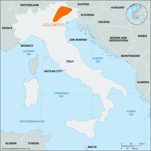
First a little background. What are the Dolomites? A spectacular mountain range located in the Alps of Northeast Italy, they were designated a UNESCO World Heritage Site in 2009 for their exceptional natural beauty and significant geologic science value. They are named for the dolomite limestone from which they formed about 250 million years ago. During this time, the area was submerged in a warm, shallow tropical sea where coral reefs thrived. Over millions of years, these reefs and other marine sediments were compressed and solidified into the dolomite rock that makes up the mountains. Over their history, the sedimentary rock eroded in a manner leaving the light-colored jagged peaks that attract tourists from around the world. There are 18 peaks over 10,000 feet. Certainly impressive, but considerably shorter (and much older) than the European Alps.

The starting point for the Short Alta Via 1 was the town of Cortina d’Ampezzo. an upscale resort surrounded by mountains that stays busy with both summer and winter tourists. Events were held here for the 1956 Winter Olympics, and the town was abuzz with construction preparing for events in the upcoming 2026 Winter Olympics. We arrived in Cortina d’Ampezzo from Venice on a comfortable 3-hour bus ride. Our hike started and ended here at the Hotel Aquilla.


I booked this trip through bookatrekking.com. They are a large outfit with hiking packages all over the world. I was happy with them. Payments were easy and I thought reasonable. The mobile app contained a lot of information, including an offline mode that allowed you to track the hike (and hike profile) using gps. I wouldn’t hesitate to use them again.
Day 1 June 19, 2025
A benefit of staying at Hotel Aquilla at the start and the end of the hike was that this allowed us to store luggage we didn’t need on the hike in a storage room for free. After checking out and storing our unnecessary luggage, we headed off to the bus stop. For this route, we caught a pair of buses to the hike start at a beautiful alpine lake called Lago di Braies. From here we would hike back to Cortina d’Amprezzo. Ticket reservations weren’t required at this time of year, but the second bus was standing room only. There were a lot of folks at the lake, but not too many were distance hikers.


After a pleasant walk around the lake, the trail heads up into the mountains. The day hikers at the lake were soon left behind. The trail climbs over 3300 feet in the next four miles, with some steep rocky sections providing cables to help avoid slips and falls. Nearing the high point the trail becomes a rock field. The payoff when you reach Forcella Sora Forno pass is well worth the climb – a vast panorama of the mountains ahead. The pass is also where we entered the Dolomiti National Park. One of many rifugios is a short drop from the pass. This wasn’t our stop for the day, but I did take the opportunity for a hydration break.


The trail from here was very pleasant and we made good time. Unfortunately, a mile or so of that was on the wrong trail and we had to back up. There are many trails in the area, it is very important to have a gps map of some format on this hike and refer to it often.

The next several miles were just a wonderful stroll in beautiful territory; the stuff memories are made of. The day ended with a steep drop of 2500 feet to our lodging for the night, Rifugio Pederü. I had low expectations when we checked into our “dormitory” style room but was pleasantly surprised when we got there. Very comfortable, electric outlet and light for each bunk, lots of gear storage space, and an excellent shower.


Hike for the day per my Garmin: 10.2 miles, 3380 feet total ascent.
Day 2 June 20, 2025
The second day started with another climb, though not as severe with 2100 feet of ascent in the first four miles and some level sections blended in. It’s the long continuous grinds that wear you down.


The trail was smooth, and there was an increase in E bikes that went along with that. Some of the rifugios we passed even had charging stations for them. This was a much more mature trail than our recent Balkan experience, with a corresponding increase in the frequency and comfort level of accommodations. I read before the hike that toilet paper on the trail was an unfortunate side effect of the increased traffic, but I did not find that to be the case.

Most of the day was in full sun exposure until the last couple of miles. Benches were placed at photogenic spots, making for welcome breaks to soak in the landscape. After a pleasant elevation profile for much of the day, we had a steep 500-foot climb at the end to reach our lodging for the next night at Rifugio Scotoni. This was another very comfortable lodging with plenty of refreshments available. We had dinner with new friends from Chili and Belgium.


Our routine for the duration of the trip was to wash our shorts, shirt, and socks in the shower or sink and hang them out to dry. Today was no different.
Hike for the day per my Garmin: 10.8 miles, 3809 feet total ascent.
Day 3 June 21, 2025
Our third day started, as always, with a long climb, this time an 1800-foot climb in about two miles. A lot of work had been done with stone and timber placement to make the section as friendly as possible, still, this was a robust start to the day. We stopped for photos at a small, alpine lake on our way to Falzarego Pass.


A stunning landscape unveiled itself as we crossed the pass. This was one of the rare occasions on the trip where cloud cover impacted views, but the swirling clouds provided a distinct character of their own.


We dropped back into the valley, only to immediately climb back a 1000-foot climb to our destination for the day, Rifugio Scoiatolli. All the rifugios had bustling day traffic that thinned out to the overnight guests over the afternoon. This rifugio was especially crowded when we arrived, due to the accessibility and the spectacular scenery. Cinque Torri (“Five Towers”) is the featured attraction here, but the 360° scenery makes this as photogenic as any spot on the hike.


While the location was spectacular, and the dinner as good as any we had on the hike, the rooms did not match. The beds were comfortable and private lockers outside the room were convenient, but eight people in one small room is a bit crowded.


Hike for the day per my Garmin: 7.8 miles, 3042 feet total ascent.
Day 4 June 22, 2025
A hard rain late afternoon the previous day was the only one we experienced on the hike, but that set the stage for a beautiful morning for the last day. The feature today was the 5100-foot descent back into Cortina d’Amprezzo rather than the ascent. Still, there was over 2000 feet of climbing, 700 in one particularly nasty stretch of steep, exposed, loose rock.


After a refreshment at Rifugio Pomedes we began the last stretch of steep downhill – literally down 1700 feet of ski slope. From there we continued the rest of the way to Cortina d’Amprezzo, mostly through pleasant forests. The hike is predominantly exposed to full sun so the sections under canopy were nice.


Hike for the day per my Garmin: 10.2 miles, 2047 feet total ascent.
Total for the hike: 39.0 miles, 12,278 feet of ascent.
Parting Thoughts…
The Short Alta Via 1 is not a technical hike, but experience with long distance hiking at moderate elevation will make the trip more enjoyable. Plenty of folks take day hikes from many potential starting points. Others take the full Alta Via 1 (75 miles), or some other combination of available trails. The Short Alta Via 1 is a good compromise providing a nice sample of the Dolomites with outstanding views, and enough of a workout to have a sense of accomplishment.