The Dolomites are well known to backpackers, skiers, and other outdoor enthusiasts from around the world. I’ve been planning to hike there for years. This was the year, with backpacking gear on hand from a recent Balkan hike with Bill Ramsey. The two hikes were relatively close to each other, and we made productive use of the time in between with some meandering in Croatia and Slovenia. There are many hikes that criss-cross the Dolomite region. We settled on the Short Alta Via 1, a four-day trek that gave a good sample of the region (Alta Via translates to “high way” in Italian).
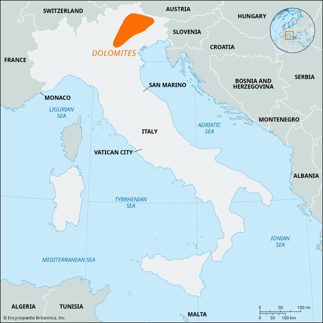
First a little background. What are the Dolomites? A spectacular mountain range located in the Alps of Northeast Italy, they were designated a UNESCO World Heritage Site in 2009 for their exceptional natural beauty and significant geologic science value. They are named for the dolomite limestone from which they formed about 250 million years ago. During this time, the area was submerged in a warm, shallow tropical sea where coral reefs thrived. Over millions of years, these reefs and other marine sediments were compressed and solidified into the dolomite rock that makes up the mountains. Over their history, the sedimentary rock eroded in a manner leaving the light-colored jagged peaks that attract tourists from around the world. There are 18 peaks over 10,000 feet. Certainly impressive, but considerably shorter (and much older) than the European Alps.
Good visual of sedimentary layers.
The starting point for the Short Alta Via 1 was the town of Cortina d’Ampezzo. an upscale resort surrounded by mountains that stays busy with both summer and winter tourists. Events were held here for the 1956 Winter Olympics, and the town was abuzz with construction preparing for events in the upcoming 2026 Winter Olympics. We arrived in Cortina d’Ampezzo from Venice on a comfortable 3-hour bus ride. Our hike started and ended here at the Hotel Aquilla.
Hotel Aquilla
Cortina d’Amprezzo with Tofana Ski Slopes in background
I booked this trip through bookatrekking.com. They are a large outfit with hiking packages all over the world. I was happy with them. Payments were easy and I thought reasonable. The mobile app contained a lot of information, including an offline mode that allowed you to track the hike (and hike profile) using gps. I wouldn’t hesitate to use them again.
Day 1 June 19, 2025
A benefit of staying at Hotel Aquilla at the start and the end of the hike was that this allowed us to store luggage we didn’t need on the hike in a storage room for free. After checking out and storing our unnecessary luggage, we headed off to the bus stop. For this route, we caught a pair of buses to the hike start at a beautiful alpine lake called Lago di Braies. From here we would hike back to Cortina d’Amprezzo. Ticket reservations weren’t required at this time of year, but the second bus was standing room only. There were a lot of folks at the lake, but not too many were distance hikers.
Lago di Braies, our starting point. Mountain climb begins at back left.
Looking across Lago di Braies to where our mountain climb starts.
After a pleasant walk around the lake, the trail heads up into the mountains. The day hikers at the lake were soon left behind. The trail climbs over 3300 feet in the next four miles, with some steep rocky sections providing cables to help avoid slips and falls. Nearing the high point the trail becomes a rock field. The payoff when you reach Forcella Sora Forno pass is well worth the climb – a vast panorama of the mountains ahead. The pass is also where we entered the Dolomiti National Park. One of many rifugios is a short drop from the pass. This wasn’t our stop for the day, but I did take the opportunity for a hydration break.
About an hour into the climb.
The climb continues.
Trail Blaze for the hike.
Rocks. There’s always rocks.
Crossing Forcella Sora Forno pass
The trail from here was very pleasant and we made good time. Unfortunately, a mile or so of that was on the wrong trail and we had to back up. There are many trails in the area, it is very important to have a gps map of some format on this hike and refer to it often.
The trail in the distance was great. Just not ours.
The next several miles were just a wonderful stroll in beautiful territory; the stuff memories are made of. The day ended with a steep drop of 2500 feet to our lodging for the night, Rifugio Pederü. I had low expectations when we checked into our “dormitory” style room but was pleasantly surprised when we got there. Very comfortable, electric outlet and light for each bunk, lots of gear storage space, and an excellent shower.
Perfect. Just perfect.
Descending to Rifugio Pederü in the valley.
Rifugio Pederü, our stop for the night.
Rifugio Pederü bunks. Nice. Very nice.
Hike for the day per my Garmin: 10.2 miles, 3380 feet total ascent.
The second day started with another climb, though not as severe with 2100 feet of ascent in the first four miles and some level sections blended in. It’s the long continuous grinds that wear you down.
Early morning climb on day 2.
Not a care in the world.
Trails side bee hives.
The trail was smooth, and there was an increase in E bikes that went along with that. Some of the rifugios we passed even had charging stations for them. This was a much more mature trail than our recent Balkan experience, with a corresponding increase in the frequency and comfort level of accommodations. I read before the hike that toilet paper on the trail was an unfortunate side effect of the increased traffic, but I did not find that to be the case.
Sometimes not, but mostly E bikes.
Most of the day was in full sun exposure until the last couple of miles. Benches were placed at photogenic spots, making for welcome breaks to soak in the landscape. After a pleasant elevation profile for much of the day, we had a steep 500-foot climb at the end to reach our lodging for the next night at Rifugio Scotoni. This was another very comfortable lodging with plenty of refreshments available. We had dinner with new friends from Chili and Belgium.
Note the hikers on the trail to give perspective to the mountains.
How do they survive??
One of many benches with a beautiful view.
Rifugio Scotoni for second night.
Europeans love flower boxes.
Our routine for the duration of the trip was to wash our shorts, shirt, and socks in the shower or sink and hang them out to dry. Today was no different.
Hike for the day per my Garmin: 10.8 miles, 3809 feet total ascent.
Day 3 June 21, 2025
Our third day started, as always, with a long climb, this time an 1800-foot climb in about two miles. A lot of work had been done with stone and timber placement to make the section as friendly as possible, still, this was a robust start to the day. We stopped for photos at a small, alpine lake on our way to Falzarego Pass.
Breakfast at Rifugio Scotoni, typical for the hike.
Climb to start day 3. That’ll get your blood flowing.
A huge amount of effort went into making this section passable.
Pretty alpine lake just off trail.
A stunning landscape unveiled itself as we crossed the pass. This was one of the rare occasions on the trip where cloud cover impacted views, but the swirling clouds provided a distinct character of their own.
Crossing Falzarego Pass.
Love the scree fields.
More dramatic cloudscapes.
We dropped back into the valley, only to immediately climb back a 1000-foot climb to our destination for the day, Rifugio Scoiatolli. All the rifugios had bustling day traffic that thinned out to the overnight guests over the afternoon. This rifugio was especially crowded when we arrived, due to the accessibility and the spectacular scenery. Cinque Torri (“Five Towers”) is the featured attraction here, but the 360° scenery makes this as photogenic as any spot on the hike.
Sometimes it appears it is just easier to go through instead of around.
How’s that for an afternoon view?
Cinque Torri, “Five Towers”.
While the location was spectacular, and the dinner as good as any we had on the hike, the rooms did not match. The beds were comfortable and private lockers outside the room were convenient, but eight people in one small room is a bit crowded.
Main dish after first course of spaghetti with fresh tomatoes and basil. No problems here.
Accomodations a little tight at Rifugio Scoiattoli.
Hike for the day per my Garmin: 7.8 miles, 3042 feet total ascent.
Day 4 June 22, 2025
A hard rain late afternoon the previous day was the only one we experienced on the hike, but that set the stage for a beautiful morning for the last day. The feature today was the 5100-foot descent back into Cortina d’Amprezzo rather than the ascent. Still, there was over 2000 feet of climbing, 700 in one particularly nasty stretch of steep, exposed, loose rock.
Beautiful start to the day.
Looking back at Cinque Torri after a couple of hours on the trail
One last tough climb, with loose gravel as additional challenge.
After a refreshment at Rifugio Pomedes we began the last stretch of steep downhill – literally down 1700 feet of ski slope. From there we continued the rest of the way to Cortina d’Amprezzo, mostly through pleasant forests. The hike is predominantly exposed to full sun so the sections under canopy were nice.
Looking down on Cortina d”Ampezzo from Rifugio Pomedes.
Just be careful.
Pleasant end after steep section coming down ski slope.
Shot of calories at the end of the hike!
Hike for the day per my Garmin: 10.2 miles, 2047 feet total ascent.
Total for the hike: 39.0 miles, 12,278 feet of ascent.
Parting Thoughts…
The Short Alta Via 1 is not a technical hike, but experience with long distance hiking at moderate elevation will make the trip more enjoyable. Plenty of folks take day hikes from many potential starting points. Others take the full Alta Via 1 (75 miles), or some other combination of available trails. The Short Alta Via 1 is a good compromise providing a nice sample of the Dolomites with outstanding views, and enough of a workout to have a sense of accomplishment.
Of all the paths you take in life, make sure a few of them are dirt.
- John Muir
Someday, I will reach a point where I decide long distance hikes aren’t for me anymore. Fortunately, I didn’t decide that this year. After contemplating an offer to hike the Tour du Mont Blanc (TMB) with a few of my hiking buddies (Heather Waldroup – chief instigator, Rusty Bingham, and Beth Jones) a few months ago, I was all in. I knew a bit about the hike but had some homework to find out what I was really getting into. Some of the background information about the hike:
The Tour du Mont Blanc is an alpine hike in western Europe circumnavigating Mont Blanc, about 103 miles long with 34,717 feet of total ascent.
The Mont Blanc Range dominates an area 60 miles by 20 miles and holds 11 summits over 13,000 feet.
Mont Blanc is French for White Mountain. It is owned by both France and Italy under a bilateral agreement and is known as Monte Bianco in Italian. At 15,777 feet, it is the highest mountain in western Europe.
The route is attributed to Horace-Bénédict de Saussure, a Swiss geologist and physicist. In 1767 he walked around the entire Mont Blanc massif looking for a possible route to climb to the summit of the unclimbed peak. Several portions of the trail had been in use for centuries.
The hike travels about 49 miles in France, 29 miles in Switzerland, and 25 miles in Italy.
The Alps are sharply featured compared to my familiar Appalachian Mountains of the eastern United States. By comparison, the Alps are approximately 45 million years old, the Rocky Mountains of the western US 70-80 million, and the Appalachians 200-300 million years old.
Tour du Mont Blanc
We hiked this profile from right to left.
There were lots of factors to consider and plans to make. Is my passport expiration date still good? What about lingering covid restrictions? What phone plan should I use? What map app should I use for navigation? How much foreign currency will I need and what is the best place to get it? Is it wise to get trip insurance (there is an overwhelming number of choices out there)? What should I pack? Do I need to be concerned about altitude sickness? Last but not least – am I physically up for this?
Heather Waldroup did the advance heavy lifting in reserving hostels and one hotel for our trek. The hostels always included breakfast, with dinners optional for an extra charge and carry out packed lunches available for the following days hike. I tempered my expectations for hostel food and was pleasantly surprised. Breakfasts were typically an average but adequate collection of jams, bread, pastries, yogurt, cereal, etc. Lunches might best be summarized as calories – a sandwich with a lot of bread and a little filling, a piece of fruit, a bag of chips. After a couple of days, I opted out for my own lunch provisions of dried fruit, protein bars, nuts, etc. And Gu gel packs for a quick pick me up. These are a small bag of slime (okay, technically “gel”) containing calories, electrolytes, caffeine and other stuff that science has determined is good for a hiker.
Dinners, however, were generally excellent. Take a picture and write home kind of excellent. More on those later.
We met in Geneva, Switzerland in advance of the hike. I flew in early to give myself a few days to adjust to the time zone shift (+6 hours) and to tour the city. The four of us filtered in over a three-day period. We visited the St Pierre Cathedral, International Red Cross Headquarters, Patek Phillipe Museum as well as numerous parks, gardens, and restaurants around town.
If you’d been along for the trip, this is what you would have experienced.
Day 1 July 15
We started our hike in the small French village of Le Houches, about an hour bus ride from Geneva with a connecting bus in Chamonix (where Dr. Frankenstein’s monster was known to frolic back in the day). Les Houches is a quaint French Alps village of about 3000 people supported primarily through tourists – skiing in the winter and TMB hikers in the summer (over 10,000 hikers per year). There are several points of entry for the hike, as well as the question of whether to hike clockwise or counterclockwise. There are advantages to any combination – we went clockwise from Le Houches.
And we’re off! On the bus from Geneva to Chamonix.
Our first view of Mont Blanc from the Chamonix bus station.
We had the same hostel for our first and last nights – Gite Michel Fagot (gite is French for ‘cottage’). They provided (for 5 €/day) the extra benefit of holding our surplus gear for our return. This was a huge help. Our room had two bunk beds, and as is the norm throughout central Europe, no air conditioning. There were community baths and showers on the floor with a couple of dozen other lodgers, so we had to work our schedules around that. Just part of the experience, no problems encountered.
Our first hostel in Les Houches, Gite Michel Fagot
Settling in at Gite Michel Fagot.
Day 2 July 16
We started off bright and early for our first day of hiking. After a bit of jostling with the hostel crowd we were out the door. After the obligatory underway photo at the arch in the center of town, we started our first day with an 11.9-mile trip with 5733 feet of incline. That included an immediate 4877-foot initial ascent to our first peak Le Brevent as we headed out of town. This is a wonderful section for outstanding vistas of Mont Blanc, with hang gliders riding the currents along the face of the mountain. The altitude, unusually warm weather, and still adjusting to the time zone shift all contributed to this being a tough day and a heck of a way to start a hike. We spread out some as the day went by as we often did. I had a chance encounter with an adult male Alpine ibex (a mountain goat indigenous to the region) along the way to our destination of Refuge de la Flegere. This was a big place, about 70 hikers. Typical for the hike, there was no wifi signal, but often a weak cell signal. I had already decided I was going to ignore the outside world to the extent possible during the hike.
And we’re off! Left to right – Rusty, Beth, Conrad, Heather.
The climb to Le Brevent with Les Houches in the valley below.
The climb to Le Brevent. I think Heather is happy.
Hang gliders seemed to stay aloft forever.
Rusty was often the point man.
Alpine Ibex.
Room at Refuge de la Flegere
Happy hour at Refuge de la Flegere.
Day 3 July 17
This was another tough day at 13.8 miles with 4565 feet of incline. The heat coupled with the incline made this my worst day on the trail. The morning started off pleasantly with a moderate climb out of Refuge de la Flegere before taking a steep drop to village of Tre-le-Champ. We encountered some weekend crowds on our way down the steep descent that made the drop slower still. After a refreshing break in the valley, we started our climb to Col de Balme, the high mountain pass that marks the French-Swiss border. This 2500-foot incline was steep, hot, and in soul-crushing full sun. I officially reconsidered my initial plan to reduce my sun exposure by wearing long pants. I ran through my water faster than I wanted to, about 5 liters on the day. Fortunately, a mountain top restaurant had an outdoor water spigot for a cool refill. We still had a few miles of steep downhill to our destination of Refuge le Peuty. This was our least favorite lodging. Steep stairs led to hot, poorly ventilated room with sleeping for a couple of dozen people – and plenty of flies. This did not make for good sleeping. Still a good day with stunning views, and our first encounter with the famous Swiss cows with bucket sized bells that could be heard for miles.
Heading out in the morning from Refuge de la Flegere.
Approaching the steep decline into Tre-le-Champ.
Heading up from Tre-le-Champ. Note the trail coming down the opposing mountain – we had just come down that one.
Approaching Col de Balme, the French-Swiss Border
Our descent into Switzerland to the village of Le Peuty.
Refuge Le Peuty.
Day 4 July 18
The third day of hiking started with a gentle decline through the small village of Le Peuty in the Trient Valley of Switzerland. The air was clear and cool, and I was refreshed but really thinking I could use a good night’s sleep. We turned up the mountain towards the Bovine summit. This was a 2400-foot incline over a 4 mile stretch but the cool morning and the forest shade made the miles pass pleasantly. We passed through a field with enormous cattle and equally enormous bells. While watching a couple of massive creatures battle, I marveled at the moxie of the man who imposed himself between them to split up the fight with a small stick. As we headed over the pass and down to our destination of the village of Champex, we chanced upon the small café Alpage de Bovine selling a wonderful variety of refreshments. I treated myself to a slice of delicious apricot pie with mint tea.
A suspended walkway overlooking Le Peuty and the Trient Valley.
I think this was my favorite image of Beth on this trip. Heading up Bovine in the early morning light.
I assumed these were bulls from their behavior, but….
This brave fellow ran out with a stick and busted up the fights.
Café Alpage de Bovine
Sampling the fare at Café Alpage de Bovine
This was a much easier day. We had 3477 feet of ascent for the day (most of it in the cool morning) and 11.6 miles in arriving at the alpine tourist village of Champex in the early afternoon. This was our sole hotel stay of the hike, Au Vieux Champex. We relaxed, enjoyed a proper cleanup and a pizza for dinner.
Heading towards Champex.
Coming into Champex.
View of the lake from our hotel Au Vieux Champex.
Day 5 July 19
After a solid night’s sleep for the first night since Geneva, I was ready to go. We walked through the town of Champex-Lac, then headed down the mountain toward the Swiss Val Ferret. The trail followed the Sentier des Champignons (“Mushroom Trail”) for a time, complete with interpretive signs detailing features of various mushrooms in the area. After reaching the valley, we began the long climb to the high mountain pass of Grand Col Ferret. This is the Swiss-Italian border. It’s still over 19 miles away and almost 5000 feet higher – we won’t reach that until tomorrow.
Morning in Champex.
Mushroom Trail sign. A lot of good information. Helps if you know French.
We started our slow steady incline up the valley, passing through several small villages. This was a departure from the typical trail we had experienced thus far. We enjoyed admiring the quintessential Swiss chalets, with precisely cut and stacked woodpiles, tidy gardens, berry vines, well-tended flower and vegetable gardens, and frequent public fountains of cool clear water.
Walking through Issert.
Looking back at Issert.
I marvelled at the precision of Swiss woodpiles.
Heather and Rusty admire the gardens.
Public water fountains were common, especially in Switzerland.
This was just a great day. I was rested, had gained my hiking legs, and was in good hiking company. The weather was perfect, and then right on cue, I heard ice cream calling my name when passing a small grocery store in the town of La Fouly. Who am I to defy fate?
The pause that refreshes. In La Fouly.
It was just a short walk from ice cream to our next lodging, Gite de la Lechere, completing 11.9 miles for the day with an easy 2529 feet of total ascent. Most of our hostels had a small, family-owned feel to them, complete with the children of the proprietors helping out, and this was no exception. Our dinners thus far on the hike had been quite good, but the bar for the future was set higher here. Our dinner started with a soup that was among the best I’ve had in my life. Stinging nettle was the secret ingredient. The main course of ham, finger potatoes, and green beans was good as well, but I would have been perfectly content to stick my head in a bucket of that soup!
La Fouly, Switzerland.
Beth approaching hostel Gite de la Lechere.
Stinnging Nettle Soup. Just amazing.
Day 6 July 20
Our fifth day of hiking started overcast with forecast for rain, but none materialized. Clouds and mist shrouded the peaks as we made our way up the remaining 2800 feet of ascent to the Swiss-Italian border, about five miles away. The heat of the first couple of days had eased. Trail traffic was light, temperatures were cool, the trail was good, and we made good time to the border. Grand Col Ferret is advertised as having some of the best views of the entire hike, but we were enveloped in clouds.
Monkshood
The approach to Grand Col Ferret from the Swiss side.
Grand Col Ferret, the Swiss-Italian Border.
As we worked our way down the Italian side of the pass, the clouds began to part, and we were greeted with incredible views. Bonjour was replaced with ciao as we passed fellow hikers. Our destination for the day was Rifugio Bonatti, a large boisterous facility with over 100 fellow hikers. This had more of a corporate feel to it than any of our other lodgings. Except paying for a frigid shower everything was fine. We hiked 12.3 miles for the day with 4384 feet of ascent.
Our views of the Italian Alps started to improve.
The Italian Val Ferret. Rifugio Bonatti is a tiny building on the left facing slope.
Checking in to Rifugio Bonatti.
Evening storms in the Italian Val Ferret.
Sleeping accomodations in Rifugio Bonatti.
Phone charging accomodations varied from hostel to hostel.
The dining room at Rifugio Bonatti was the largest by far of any we stayed at. And this was only half of it.
Day 7 July 21
The TMB to this point had been characterized by up, down, way up, way down, up, down. No relaxed sauntering through flower filled alpine meadows. Most of my hiking experience has been with inclines no more than 750 feet per mile – 1000 feet per mile seems more common here. I pondered where in the heck did Hannibal bring his elephants over the Alps. But today started differently. The first few miles heading out from Rifugio Bonatti were delightfully level, with air scrubbed clean by overnight rains. I embraced the moment. It didn’t last. After inhaling a mushroom pizza in the little Italian town of Courmayeur, we climbed a tough 2300-foot climb to our next lodging at Le Randonneur Rifugio (randonneur is French for hiker). We hiked 11.9 miles for the day with 3378 feet of ascent. Any lingering discussions of hike shortcuts using ski lifts or buses fell by the wayside by this point. We had our hiking legs and were in it for the duration with no short cuts.
Beautiful morning hiking from Rifugio Bonatti.
The Italian Val Ferret. One of my favorite pictures for the entire trip.
Hiking into Courmayeur.
Wonderful mushroom pizza in Courmayeur.
Le Randonneur Rifugio. Outstanding.
Day 8 July 22
Our seventh day of hiking was our longest at 16.8 miles, with 4139 feet of ascent, but we took it in stride. After about a 1900-foot climb to start the day, we entered a stretch of several miles of outstanding alpine landscapes on our way to Col de la Seigne, the pass at the Italian-Swiss border. The entire valley Vallon de la Lée Blanche was open for us to admire as we climbed our way to the pass. It’s important to remember to stop and soak in the moment at times like this.
I was amused by the warning of head over heels falls.
Rusty enjoys the view.
View from Col de la Seigne.
Col de la Seigne, the Italian-French border.
We made our descent of 3200 feet over about seven miles to our lodging for the night, Auberge de la Nova, in the tiny village of Les Chapieux (auberge: a house providing food and shelter for travelers). This was a splendid lodging with en suite bathrooms. This was also my favorite dinner so far – fork tender marinated beef with lentils and roasted potatoes followed by panna cotta with berry sauce for dessert. My nose and stomach took over and I neglected to take pictures. There were no leftovers. A note on dining – at home I make modest effort to limit carbohydrates, fat, red meat, etc., but when hiking it’s game on. Put it in front of me and I’ll eat. And if it is some sort of local specialty that’s even better.
Beth and Heather descending into France.
Auberge de la Nova in the tiny town of Les Chapieux.
Boot racks common in the hostels. They don’t want your smelly dirty boots walking around their hostel.
Day 9 July 23
We started the day with about 3000 feet of incline in the first 3 miles. This wasn’t the end of climbing for the hike, but it was the last major ascent. It was a lovely climb through French Alps with meadow grasses blowing in the breeze. An entire herd of ibex scampered on the mountainside. We were past peak wildflowers on this hike, but this was one of the locations where we still had a nice display.
Orchids on the approach to Col du Bonhomme
Looking back down the valley to Les Chapieux.
We passed the Col du Bonhomme Pass and began our long, steep descent to our next stop at Gite le Pontet. There were treats to be had before we got there. After a short visit to the small parish church Notre Dame de la Gorge, we patronized a vendor selling ice cream on the grounds. We all enjoyed a freshly made fruit ice cream cone. I chose to have mine made from black currants and was not disappointed.
The descent from Col du Bonhomme.
The Chapel of Notre Dame de la Gorge.
Roadside vendor selling ice cream by Notre Dame de la Gorge.
Black currant ice cream, yum!
Heather and Beth relax after enjoying their ice cream.
We had rooms rented for the night at Gite le Pontet for the night, a full-service campground with something for about anyone – swimming, putt putt, volleyball, etc. We finished the day with 3299 feet of ascent and 12 miles.
Our cabin at Gite le Pontet.
Day 10 July 24
The days were easy now. The worst of the heat was over, the major ascents were done, and the distances were shorter. Our hike to Refuge du Fioux was a pleasant 8.6 miles with 2382 feet of ascent, passing through several small villages. I purchased some fresh red currants from some entrepreneurial young lads selling from a roadside stand. Rusty took a separate high route to check out a suspended bridge. We converged at the Refuge, arriving early. After a relaxing afternoon, I enjoyed another “best dinner so far”, Basque Chicken with rice.
A young lady with her children by the public fountain at a small French village.
Young entrepreneurs selling lemonade and fresh picked red currants. I bought some of the currants.
Our last hostel on the trail, Refuge du Fioux.
Poulet Basquaide, yet another fantastic dinner.
Day 11 July 25
This was our last day on the trail, a short 4.6 miles back to Les Houches with only 507 feet of ascent. I set my pace at “mosey” as I made my way towards town. We completed our end of trail photo at the arch, then enjoyed looking around a farmers’ market for a bit before checking in at our starting hostel, Gite Michel Fagot.
Our last morning to hike, joined by our new friend Oicin Wong.
The view when you mosey properly. On my way back to Les Houches and the end of the trail.
Entering Les Houches.
The next morning we headed our separate ways. Our only difficulties on the trip were trivial. Rusty and I did not enjoy our melted glacier showers at Rifugio Bonatti, Beth broke an egg in her backpack, and Heather had some delayed flight issues at the end to sort through. No one was injured or got sick. If anyone got blisters they didn’t complain about them. We had no problems with any of our reservations. All in all, one of my favorite hiking experiences.
I find as I get older the passing of time just gets faster and faster. The events of one day just roll into the next over and over. Its useful to take trips like this, to strip yourself from your daily trappings and get out into new adventures. They give us a stake in the ground of time that we can hold on to, to pause and reflect on some day in the future.